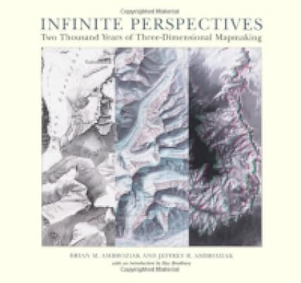
Infinite Perspectives: Two Thousand Years of Three-Dimensional Mapmaking
by Brian M. Ambroziak, Jeffrey R. Ambroziak
On This Page
Description
"For over two thousand years, mapmakers have struggled with the problem of representing a three-dimensional planet on a two-dimensional canvas. Infinite Perspectives traces the artistic and scientific evolution of the age-old quest to conquer this challenge. From ancient Greek coins to detailed nineteenth-century Swiss Alpine maps to the inconceivably scaled landscapes of Mars, more than eighty color maps illustrate history's most enduring attempts to pay cartographic homage to the show more multidimensional landscape. An additional twenty plates present a revolutionary cartographic technique that allows viewers wearing ordinary 3-D glasses to examine the Earth and beyond with an accuracy and clarity undreamed of even a generation ago. The first comprehensive overview of the ancient saga of relief mapmaking, Infinite Perspectives is a treasure for the map enthusiast, the cartographer, and the explorer in all of us."--Jacket. show lessTags
Recommendations


Member Reviews
Review Infinite Perspective Two thousand years of three dimensional mapmaking
The title is ambitious and points one in the direction of a problem and a survey of the solutions to the problem. The problem is how do mapmakers represent on a two dimensional surface ( the map in say an atlas or a book or a chart) the third dimension to show landscapes, mountains, heights, uneven terrain. Brian and Jeffrey Ambroziak sets out to explain the problem and range widely in their text across different societies and cultures and the different ways in which the geographers and scientists have portrayed contours and elevations. The book represents the product of their passion and their deep knowledge of their subject with a lot of out of the box show more thinking. Brian has a degree in architecture and Jeffrey is an attorney. This is a magnificently produced book , published by Princeton Architectural Press. It is a large and awkward to handle book as it measures 12.5 inches x 14.5 inches wide. – you need to read the book on a large flat table. This is a scientific book but it also brings pleasure to the amateur as the illustrations of the many maps are well explained in captions.
I found it fascinating that the authors founded Ambroziak Third Dimension Technologies which “ specializes in the research, development and licensing of Geographic Information Systems”. Together with a Russell Ambroziak they developed the Ambroziak Infinite perspective projection which is the technique used to create the many three dimensional maps presented in this book. The book comes equipped with two pairs of 3 D plastic viewers (not very durable) and the back cover has a pocket containing a large 3 D or Infinite perspective map of the Grand Canyon. It is both a fun book and a serious scientific book at the same time. I thought though that the Ray Bradbury introduction added little to the book for me – perhaps if you are a science fiction fan it is important. Start work on the book on about page 15. I liked the wonderful selection of maps in the book – from the ancient Micronesian sailing chart of the Marshall Islands ( but no precise date given) to a National Geographic Map of Mount Everest of 1991. There is a fascinating Lubeck made world map dating from 1475- (the earliest known printed world map) There are a number of reproductions of 19th century Swiss maps. There is considerable discussion together examples showing cartographic advances in North America. The chapter on Digital Mapping shows how aerial photography, innovative surveying techniques, space garnered digital data , satellite imagery of the earth all added to knowledge and science. Finally a discussion of the origins and application of Ambroziak Infinite Perspective Projection illustrated with a 3 D bird’s eye view of San Francisco dating from 1999 contrasted with an 1878 bird’s eye view of the City from the Bay Landing. This book is a pleasure and a delight and is a must in any collection of history of maps and cartographic books. To add a personal note my grandchildren , aged 4 and 6, loved the fun of looking at the 3 D maps and immediately wanted to make their own “aged” treasure maps and immediately came the request to take Infinite Perspectives home and if I was not prepared to give them the book would I not consider a loan! The original price of the book was $75 and it was published in 1999. Definitely earns 5 stars and is a book that changes one's understanding of a key problem of cartographers around the world and though the ages. show less
Un libro muy interesante que muestra la manera en que a través del tiempo se ha intentado representar el relieve terrestre en mapas bidimensionales.
Jan 20, 2007Spanish
Ratings
Members
- Recently Added By
Author Information
2 Works 65 Members
1 Work 47 Members
Some Editions
Classifications
- Genres
- Nonfiction, Art & Design, History, General Nonfiction
- DDC/MDS
- 526 — Natural sciences & mathematics Astronomy Mathematical geography
- LCC
- GA125 .A48 — Geography, Anthropology and Recreation Mathematical geography. Cartography Mathematical geography. Cartography Cartography Map drawing, modeling, printing, reading, etc.
- BISAC
Statistics
- Members
- 47
- Popularity
- 636,775
- Reviews
- 2
- Rating
- (4.70)
- Languages
- English
- Media
- Paper
- ISBNs
- 1