
Raymond Gillespie (–2024)
Author of Seventeenth-Century Ireland
About the Author
Raymond Gillespie teaches in the department of History, NUI Maynooth. He has written extensively on the social, economic and cultural history of early modern Ireland. R.F. Foster is Carroll Professor of Irish History at the University of Oxford. He is the author of many books on the political, show more social, cultural and literary history of Ireland. He is a Fellow of the British Academy, an Honorary Member of the Royal Irish Academy and a well-known cultural commentator and critic. show less
Series
Works by Raymond Gillespie
Galway : history & society : interdisciplinary essays on the history of an Irish county (1996) 12 copies
The Oxford History of the Irish Book. Volume III: The Irish Book in English, 1550-1800 (2006) — Editor — 10 copies
Reading Ireland: Print, Reading and Social Change in Early Modern Ireland (Politics, Culture & Society in Early Modern B (2005) 9 copies
TRANSFORMATION OF THE IRISH ECONOMY, 1550-1700 (STUDIES IN IRISH ECONOMIC AND SOCIAL HISTORY) (1991) 9 copies
The Vestry Records of the Parishes of St Catherine and St James Dublin, 1657-1692 (Texts and Calendars) (2002) 7 copies
Scholar Bishop: The Recollections and Diary of Narcissus Marsh, 1638-1696 (Irish Narrative Series) (2003) 6 copies
The Chapter Act Book of Christ Church Dublin, 1574-1634 (History of Christ Church Cathedral, Dublin) (1997) 5 copies
Seventeenth-Century Dubliners and Their Books (The Sir John T. Gilbert commemorative lecture) (2005) 4 copies
Irish Europe 1600 - 1650 Writing and Learning The Ulster earls and Baroque Europe, Irish communities in early Modern Europe, Irish Migrants (2013) 3 copies
Irish Historic Towns Atlas - Compilation Volume I (Kildare ∙ Carrickgergus ∙ Bandon ∙ Kells ∙ Mullingar ∙ Athlone) (1996) 3 copies
Colonial Ulster 1 copy
Associated Works
Surveying Ireland's Past: Multidisciplinary Essays in Honour of Anngret SIMMs (2004) — Contributor — 11 copies
Conquest and Resistance: War in Seventeenth-Century Ireland (2001) — Contributor, some editions — 2 copies
Ríocht na Midhe, Vol. X (1999) — Contributor — 1 copy
Tagged
Common Knowledge
- Canonical name
- Gillespie, Raymond
- Date of death
- 2024-02-08
- Gender
- male
- Occupations
- university professor
- Organizations
- Maynooth University
- Relationships
- Cunningham, Bernadette (wife)
Members
Reviews
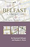
Belfast C.1600 to 1900: The Making of the Modern City (Irish Historic Towns Atlas) by Raymond Gillespie
http://nhw.livejournal.com/940032.html
This is a 19-page pamphlet produced jointly by the Royal Irish Academy and Belfast City Council, attached to a gorgeous multi-coloured map illustrating the developing historical streetscape, with today's map faintly visible in the background. The landscape we live in is a palimpsest; this little publication helps to establish what was there before.
What is most fascinating is that the defensive walls built in 1642 almost precisely map the security zone I show more remember well from my childhood. There are one or two shifts of a few metres, but on the whole the twentieth century security gates were placed pretty much on top of where the town's defences had been, a third of a millennium earlier. Extraordinary. (If you consider Dublin's history, by contrast, the commercial heart of the city has slipped about a kilometre downriver over the last thousand years.)
Anyway, I found it fascinating. show less
http://nwhyte.livejournal.com/1294789.html
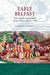
This short (180 pages) and readable book tells the story of Belfast up to 1750, using what there is of contemporary records and archæological evidence. I learnt a lot from it (more than from my previous reading). As a schoolchild I had been taught the early history of the city as originating around the River Farset, which now flows under Castle Street, Castle Place and High Street (eating away the foundations of the Albert Clock to make it lean show more slightly). The truth is more complicated.
In fact the medieval settlement of Belfast was roughly a block farther south - the castle was roughly on Castle Lane, and what settlements there were around it appear to have been on Anne Street - although the oldest church in Belfast is generally described as being sited on High Street, its original entrance was from Anne Street. This is because that axis was the centre of a spit of land between the Farset River (now High Street) to the north and the original course of the Blackstaff (roughly Donegall Square North / Chichester Street / Victoria Square) to the south, leading from the castle to the original ford or causeway across the Lagan which was fairly close to where the Queen's Bridge is now.
The castle lay at the boundary between different Gaelic chieftains' territories, and was never held by anyone for very long. The Earl of Essex proposed settling it as a town in the 1570s but died horribly. Eventually the Chichester family, who became the Earls of Donegall (sic), took it on and rapidly developed the town in the first decades of the seventeenth century.
Here I expected that we would switch back into the narrative I learned at school of a development centred around High Street. But I was out by a block again, though in the other direction this time: the seventeenth-century town took Waring Street as its principal axis, though the church remained on the southern shore of High Street, on (or even off) the edge of town. The Donegalls developed a new castle on the site of the old one, but it was for ostentation rather than defence, and they preferred to have the townsfolk living at arms length, farther north.
The next major development came with the conflict of the 1640s. In 1641, the largely Protestant townsfolk managed to fight off Catholic insurgents and became a haven for displaced refugees from elsewhere in Ulster. The town's defensive ramparts were built in 1642, but Belfast changed hands several times over the next few years between Royalist, Parliamentarian and Scottish forces, so the ramparts probably weren't much use (Gillespie suggests they were badly designed and the maps show clearly that they left a large gap at the northern edge of town).
Over the second half of the seventeenth century Belfast thrived, as the local political situation settled down (King Billy passed through in 1690). But partly as a result of the forced population movements of 1641, it had become the most militantly Presbyterian town in Ireland, and this made for unhappy cohabitation with the Donegalls. The economy slumped in the eighteenth century, and Belfast was hit particularly badly. the Donegalls were unable to provide leadership (the third earl was killed fighting in Spain in 1706, his son who lived to 1757 apparently had a learning disability, and the family became less fond of Belfast after the earl's three daughters were killed when the castle burned to the ground in 1708. Although the Donegalls fought and won their battles with the (mainly Presbyterian) merchants for political domination of the town, the legacy was one where the landlords were not really disposed to foster the local economy. Again, returning to my schoolbook, the story of Belfast starts to pick up with the linen trade in the later eighteenth century, but really this could have happened fifty years earlier if the Donegalls and merchants had come to terms. The fifth earl / first marquess was prepared to forgive and forget, and started the great push of development after 1757.
I was really struck by the similarities between the early histories of Belfast and New Amsterdam / New York. Belfast was founded about fifteen years earlier, but equally as part of a colonisation project, and both found themselves, after a few decades of development, playing rather marginal roles in the geopolitical conflicts of the mid to late sixteenth century. (The Belfast defensive rampart of 1642 was as militarily useless as the wall built to protect New York in 1653.) Both are well-situated on usable harbours at the natural confluence of trading routes into their respective hinterland. But a century after their foundation, Belfast was slumping while New York was booming.
New Amsterdam, of course, started life as a project of the Dutch government rather than just of one family, and I suspect another factor may have been that potential settlers were more terrified of Irish Catholics than Native Americans. But even so, the two projects were developing at relatively level pegging for their first few decades (New York's population in 1646 was about 400, Belfast had 589 taxpayers in 1660 so it population must have been several times bigger). The real difference is that Belfast remained a family fiefdom - the Donegalls were on the winning side of all the seventeenth century wars, apart from a brief interlude in the 1640s - while New Amsterdam was captured by the British, who then had to come to terms with the population - who accepted the rebranding of the city as 'New York' but held onto (and indeed strengthened) various cultural and religious rights not enjoyed at the mouth of the Farset. All very thought-provoking. show less

Lists
You May Also Like


Associated Authors
Statistics
- Works
- 42
- Also by
- 4
- Members
- 312
- Popularity
- #75,594
- Rating
- 4.1
- Reviews
- 3
- ISBNs
- 48