LC ClassificationGA359

Selected Works (865 total)

500 items
Mercator: The Man Who Mapped the Planet
Map Addict: A Tale of Obsession, Fudge & the Ordnance Survey
Solving the Puzzle Under the Sea: Marie Tharp Maps the Ocean Floor
Mapping Boston
Sea Monsters on Medieval and Renaissance Maps
The World of Gerard Mercator: The Mapmaker Who Revolutionized Geography
Mr Selden's Map of China: the spice trade, a lost chart and the South China Sea
Soundings: The Story of the Remarkable Woman Who Mapped the Ocean Floor
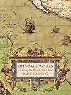
Imagined corners: exploring the world's first atlas
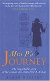
Mrs.P's Journey: The Remarkable Story of the Woman Who Created the A-Z Map
A History of the 20th Century in 100 Maps
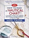
How to Read a Nautical Chart : A Complete Guide to the Symbols, Abbreviations, and Data Displayed on Nautical Charts
The Cartography of North America: 1500-1800
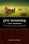
Epic Wanderer: David Thompson and the Mapping of the Canadian West
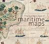
The Charting of the Oceans: Ten Centuries of Maritime Maps
The Coast Mappers
Ocean Speaks: How Marie Tharp Revealed the Ocean's Biggest Secret
Mapping the Nation: History and Cartography in Nineteenth-Century America
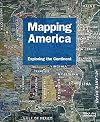
Mapping the West: America's Westward Movement 1524-1890
Historic Maritime Maps
The Mapmakers' Quest: Depicting New Worlds in Renaissance Europe
The Sea Chart: The Illustrated History of Nautical Maps and Navigational Charts
Mapping the Great Game: Explorers, Spies and Maps in 19th-century Asia
The Mapping of America
British maps and map-makers
Mapping America: The Incredible Story and Stunning Hand-Colored Maps and Engravings that Created the United States
Mapping an Empire: The Geographical Construction of British India, 1765-1843
Scotland: Mapping the Nation
Where Is Here : Canada's Maps and the Stories They Tell
Mapping for Stonewall: the Civil War Service of Jed Hotchkiss
Sea Monsters: A Voyage around the World's Most Beguiling Map
Ptolemy's "Geography": An Annotated Translation of the Theoretical Chapters
The Mapping of New Spain: Indigenous Cartography and the Maps of the Relaciones Geograficas
Mapping America: Exploring the Continent (Mapping (Black Dog))
English Maps: A History
The Golden Age of Maritime Maps: When Europe Discovered the World
Washington in Maps
Nautical Chart Symbols Abbreviations and Terms: Chart No. 1 - United States of America
Lost Islands: The Story of Islands That Have Vanished from Nautical Charts
Los Angeles in Maps
Early Sea Charts
Maps of NORTH America
The Southeast in Early Maps
Hitting the Road: The Art of the American Road Map
Underground Maps After Beck
The New Map of Empire: How Britain Imagined America before Independence
Holy Land in Maps
Degrees of Latitude: Mapping Colonial America (Williamsburg Decorative Arts Series)
Early Mapping of the Pacific: The Epic Story of Seafarers, Adventurers and Cartographers Who Mapped the Earth's Greatest Ocean
The United States in Old Maps and Prints (U.S. Old Maps Series)
Maps for America : cartographic products of the U.S. Geological Survey and others
Representing the Republic : mapping the United States, 1600-1900
Renaissance Ethnography and the Invention of the Human: New Worlds, Maps and Monsters
Symbols and Abbreviations Used on Admiralty Charts (Int 1 - Edition 3)
Charts of War: The Maps and Charts That Have Informed and Illustrated War at Sea
Mapping Latin America: A Cartographic Reader

Related Tags

16th century (77) 17th century (51) 18th century (46) 19th century (44) Africa (6) American (6) American Revolution (5) American West (10) architecture (11) army (6) art (38) art history (8) bibliography (12) Biographies (8) biography (261) boats (5) book history (6) books about books (8) Boston (37) Britain (18) British (7) British history (17) British Isles (17) California (26) Canada (42) cartography (917) coffee table (5) colonialism (14) cultural history (7) design (6) Devon (8) discovery (9) early modern (10) earth (5) Edinburgh (7) England (28) English History (8) Europe (27) European History (22) exploration (74) genealogy (11) geography (309) geology (19) Germany (6) Great Britain (19) Hawaii (10) history (753) history of science (33) imperialism (10) India (17) islands (6) Italy (6) Korea (5) Latin America (12) London Underground (9) map (33) mapmaking (27) maps (814) maritime (36) maritime history (19) Maryland (8) medieval (14) Mexico (10) Michigan (8) Middle Ages (5) Middle East (5) military (6) military history (8) monsters (6) nature (9) nautical (19) North America (23) ocean (32) oceanography (26) oceans (28) Pacific (7) picture book (38) politics (7) reference (63) Renaissance (34) Russia (13) sailing (28) science (96) scientists (14) Scotland (37) sea (15) ships (6) social history (6) South America (7) Southwest (5) Texas (6) topography (21) travel (41) UK (10) underground (6) urbanism (6) US (14) USA (51) Virginia (28) Washington DC (14) women (20) women's history (5)