Tag Wisconsin--Maps
Tagged Works

2
1
![Wisconsin atlas & gazetteer [atlas] : topographic maps of the entire state](https://pics.cdn.librarything.com/picsizes/49/15/49151524-g-wcv13-h200-w100-pv25_5a79542b37514a6b414d6741_v9.jpg)
1
![Escanaba, Michigan-Wisconsin [map] : 1:100,000-scale metric topographic map. 30 x 60 minute quadrangle](https://pics.cdn.librarything.com/picsizes/46/26/46263834-g-wcv13-h200-w100-pv25_5a78727577514a6b414d6741_v9.jpg)
1
![Manistee, Michigan-Wisconsin [map] : 1:100,000-scale metric topographic map. 30 x 60 minute quadrangle](https://pics.cdn.librarything.com/picsizes/46/89/46896341-g-wcv13-h200-w100-pv25_5a39575579774a6b414d6741_v9.jpg)
1
![Wakefield, Michigan-Wisconsin [map] : 1:100,000-scale metric topographic map. 30 x 60 minute quadrangle](https://pics.cdn.librarything.com/picsizes/45/90/45903451-g-wcv13-h200-w100-pv25_5a31747576414a6b414d6741_v9.jpg)
1
![Professor Pathfinder's University of Wisconsin and central Madison [map] / Nat Case, editor and cartographer](https://pics.cdn.librarything.com/picsizes/49/35/49350054-g-wcv13-h200-w100-pv25_5a36594638514a6b414d6741_v9.jpg)
1
![Apostle Islands National Lakeshore, Wisconsin [map] : full park topo map, 3-D overview map](https://pics.cdn.librarything.com/picsizes/52/96/52962295-g-wcv13-h200-w100-pv25_5a2f636a4b414e6b414d6741_v9.jpg)
1

1

1

1
1
- An atlas of Wisconsin by Charles W. Collins
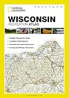
- Wisconsin recreation atlas : detailed topographic maps, complete road network, extensive recreation resources, hunting and fishing information by National Geographic Magazine
- Wisconsin atlas & gazetteer [atlas] : topographic maps of the entire state
- Escanaba, Michigan-Wisconsin [map] : 1:100,000-scale metric topographic map. 30 x 60 minute quadrangle by United States Geological Survey
- Manistee, Michigan-Wisconsin [map] : 1:100,000-scale metric topographic map. 30 x 60 minute quadrangle by United States Geological Survey
- Wakefield, Michigan-Wisconsin [map] : 1:100,000-scale metric topographic map. 30 x 60 minute quadrangle by United States Geological Survey
- Professor Pathfinder's University of Wisconsin and central Madison [map] / Nat Case, editor and cartographer by Nat Case
- Apostle Islands National Lakeshore, Wisconsin [map] : full park topo map, 3-D overview map
- Superior reference atlas of Wisconsin and the world by George Franklin Cram
- Wisconsin: Its counties, townships & villages by Wendy Zastrow Uncapher
- The Atlas of Wisconsin: General Maps and Gazetteer by Arthur Howard Robinson
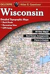
- Wisconsin Atlas & Gazetteer by DeLorme Publishing
Using the Tag
ME_Dictionary (6), NevillePublicMuseum (3), oldmanriver1951 (1), HIHS (1), ccarman114 (1)
Related Series
Aliases and Translations
Includes: Wisconsin--Maps, Wisconsin -- Maps, wisconsin - maps, Wisconsin-Maps, wisconsin--maps, wisconsin -- maps, wisconsin-maps
Google Books Ngram Viewer
Data from Books Ngram Viewer