
Paul Hindle
Author of Medieval Roads and Tracks
About the Author
Works by Paul Hindle
Pendleton (North) 1889: Lancashire Sheet 104.01 (Old Ordnance Survey Maps of Lancashire) (1999) 4 copies
Shap, Ullswater & Appleby 1895: One Inch Sheet 030 (Old Ordnance Survey Maps - Inch to the Mile) (2003) 4 copies
Whitehaven and Workington 1903-1914: One Inch Sheet 28 (Old Ordnance Survey Maps - Inch to the Mile) (2007) 2 copies
Atherton (SW) and Howe Bridge 1906: Lancashire Sheet 94.15 (Old O.S. Maps of Lancashire) (2003) 2 copies
Rochdale (SW) and Sudden 1908: Lancashire Sheet 88.08 (Old Ordnance Survey Maps of Lancashire) (2007) 1 copy
Heywood (North) & Hooley Bridge 1908: Lancashire Sheet 88.07 (Old Ordnance Survey Maps of Lancashire) (2007) 1 copy
Maryport and Siloth 1903: One Inch Sheets 16 and 22 (Old Ordnance Survey Maps - Inch to the Mile) (2007) 1 copy
Keswick and the Northern Lake District 1903: One Inch Sheet 29 (Old Ordnance Survey Maps - Inch to the Mile) (2007) 1 copy
Maps for Historians 1 copy
Medieval roads (2nd edition) 1 copy
Tagged
Common Knowledge
- Legal name
- Hindle, Brian Paul
- Gender
- male
- Occupations
- Senior Lecturer in Geography, University of Salford (1972-2000)
Retired 2000 - Organizations
- Manchester Geographical Society
Manchester Bolton and Bury Canal Society - Map Location
- UK
Members
Reviews
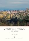
Paul Hindle's slim volume Medieval Town Plans (64 pp. including index) is a short but useful example of how history, geography and archaeology can (and should) be used together. His goal is to consider the growth of the medieval town in conjunction with economic growth and trade. He contends that while early settlements grew up around fortified areas, later towns tended to grow out of market areas instead of defensive sites.
Next, he illuminates strategies to chart how towns grew, which show more include not only the common sources used by historians (charters and the like) but also maps, archaeological reports, and (probably most commonly overlooked by historians) the town itself -- pointing out features that most often are original and less likely to have changed or moved. He then considers the major features of medieval towns, such as markets, churches and walls, and shows how to trace them in relation to other changes.
The large number of clear reproductions of town plans and maps and photographs are possibly the best feature; he takes care to illustrate every step of his method with good examples. The text is short but easily readable. Hindle gives a clear and very practical introduction to a toolset useful to anyone interested in medieval urban history. show less
Lists
You May Also Like


Statistics
- Works
- 42
- Members
- 275
- Popularity
- #84,338
- Rating
- 3.1
- Reviews
- 1
- ISBNs
- 44