
DeLorme Publishing
Author of The Maine Atlas & Gazetteer
About the Author
Series
Works by DeLorme Publishing
Delorme West Virginia Atlas 2 copies
Map'n'Go Version 3.0 1 copy
Street Atlas USA Version 4.0 1 copy
Map'n'Go Version 2.0 1 copy
Map'n'Go Version 5.0 1 copy
Lettura del vangelo di Marco 1 copy
White Mountain National Forest Trails Map & Guide: With 250 Up-To-Date Trail Descriptions (1998) 1 copy
Street Atlas USA 2.0 1 copy
Street Atlas USA Version 6.0 1 copy
Street Atlas USA 6.0 1 copy
Ohio Atlas & Gazeteer-1999 1 copy
Highway Map: New England 1 copy
Tagged
Common Knowledge
- Canonical name
- DeLorme Publishing
- Legal name
- DeLorme Publishing Company
- Gender
- n/a
- Nationality
- USA
- Birthplace
- Yarmouth, Maine, USA
- Associated Place (for map)
- Maine, USA
Members
Reviews
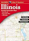
I love this IL edition compared to the neighboring states I own, such as those for Iowa and Indiana, because it not only shows every single road, it labels them! This is apparently due to the Illinois volume not having going through DeLorme's redesign process, yet. My only complaint is that sometimes I find it difficult to judge the thickness of the red lines used for roads and I end up on an less-improved grade than I'd planned for.

Love this! It is a giant atlas with gigantic maps of Nebraska. Such big scale allows infinite detail - rivers, creeks, springs, roads, trails, two-ruts-through-a-pasture! There are names of small villages that exist only as local lore. There are major ranches - mostly historic names rather than current names - scattered throughout the pages of western Nebraska.
I have found a few misspellings and typos, but it is overwhelmingly accurate. And so much fun!
I have found a few misspellings and typos, but it is overwhelmingly accurate. And so much fun!
I learned about DeLorme maps when I worked for a fairly well-known land use planning firm. All of the planners had a passion for maps, and we used the DeLorme atlases as bases for any number of planning maps.
The detail in these maps is wonderful. They each combine topographic, geographical, and roads in excellent detail. They are exceptionally suited to exploring back roads and back country, especially if you don't have much idea about the lay of the particular land you're exploring. DeLorme show more tries to keep all of its maps up-to-date, and is now, from what I understand, using satellite data to ensure the most accurate representations possible.
So, go off exploring someplace you've never been before, but make sure that you take these maps with you. show less
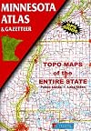
These are in process of revision, the atlases for states west of the Appalachians are not as necessary as those for Eastern states where metes and bounds surveying holds sway. However, this atlas is still useful as a large-scale reference which appears to show every one of Minnesota's 10,000+ lakes by name.
You May Also Like


Associated Authors
Statistics
- Works
- 132
- Members
- 3,324
- Popularity
- #7,696
- Rating
- 4.2
- Reviews
- 37
- ISBNs
- 254
- Languages
- 2