MDS 912.411
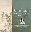
Wording: History & geography Geography & travel Maps and plans of surface of earth and of extraterrestrial worlds Maps of Europe British Isles - UK, Great Britain, Scotland, Ireland Scotland
Dewmoji: 🗺️🚂📍🏰??
0 Computer science, information & general works 252,013 ℹ️ | 1 Philosophy & psychology 270,129 🧠 | 2 Religion 681,242 🙏 | 3 Society, government, & culture 1,328,382 👫 | 4 Language 209,883 💬 | 5 Natural sciences & mathematics 431,918 🔬 | 6 Applied science & technology 940,635 💡 | 7 Arts & recreation 1,031,850 🎨 | 8 Literature & rhetoric 1,436,736 📚 | 9 History & geography 837,760 🗺️ |
90 History 36,727 🔙 | 91 Geography & travel 163,376 🚂 | 92 Biographies, Genealogy, Healdry 88,906 👩 | 93 History of ancient world (to ca. 499) 40,802 📜 | 94 History of Europe 209,479 🏰 | 95 History of Asia 53,941 🏯 | 96 History of Africa 17,044 🦁 | 97 History of North America 188,701 🦃 | 98 History of South America 15,750 🍠 | 99 Oceania & Polar Regions 23,034 🗿 |
910 modified standard subdivisions of Geography and travel 26,567 🚂 | 911 Atlases & Maps 1,908 🔙 | 912 Maps and plans of surface of earth and of extraterrestrial worlds 12,709 📍 | 913 Travel to Specific Places 3,456 📜 | 914 Geography of and travel in Europe 48,846 🏰 | 915 Geography of and travel in Asia 12,863 🗻 | 916 Geography of and travel in Africa 5,587 🦁 | 917 Geography of and travel in North America 37,862 🌽 | 918 Geography of and travel in South America 2,826 🍠 | 919 Geography of and travel in Australasia, Pacific Ocean islands, Atlantic Ocean islands, Arctic islands, Antarctica and on extraterrestrial worlds 10,752 🗿 |
912.0 modified standard subdivisions 550 | 912.1 Maps of Areas, regions, places in general 456 🔙 | 912.2 [not used] 62 🗺 | 912.3 Maps of Ancient world 57 📜 | 912.4 Maps of Europe 3,830 🏰 | 912.5 Maps of Asia 494 🗻 | 912.6 Maps of Africa 186 🦁 | 912.7 Maps of North America 2,152 🌽 | 912.8 Maps of South America 77 🍠 | 912.9 Australasisa, Pacific Ocean Islands, Atlantic Ocean Islands, Arctic Islands, Antarctica, extraterrestrial worlds 530 🗿 |
912.40 3 | 912.41 British Isles - UK, Great Britain, Scotland, Ireland 929 | 912.42 England & Wales 1,269 | 912.43 Germany and central Europe 303 | 912.44 France 188 | 912.45 Italy, San Marino, Vatican City, Malta 213 | 912.46 Spain, Andorra, Gibraltar, Portugal 147 | 912.47 Russia and neighbouring east European countries 58 | 912.48 Scandinavia 202 | 912.49 Other European Countries 249 |
912.410 Standard subdivisions 4 | 912.411 Scotland 167 | 912.412 Northeastern Scotland 51 | 912.413 Southeastern Scotland 50 | 912.414 Southwestern Scotland 99 | 912.415 Ireland 68 | 912.416 Northern Ireland; Donegal County, Monaghan County, Cavan County of Republic of Ireland 30 | 912.417 Republic of Ireland (Eire) 43 | 912.418 Leinster 36 | 912.419 Munster 9 |
912.4110 | 912.4111 Northern Scotland 3 | 912.4112 | 912.4113 Orkney and Shetland Islands authorities 21 | 912.4114 Western Isles (Outer Hebrides) Islands Authority 14 | 912.4115 Highland Region, Scottish Highlands 86 | 912.4116 | 912.4117 1 | 912.4118 Western Districts of Highland Region 2 | 912.4119 |
Selected Works under MDS 912.411 (167)
158 items


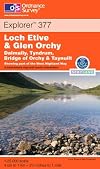


- Landranger Map 041: Ben Nevis, Fort William and Glen Coe by Ordnance Survey
- Landranger Map 036: Grantown & Aviemore, Cairngorm Mountains by Ordnance Survey
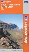
- Landranger Map 032: South Skye & Cuillin Hills by Ordnance Survey
- Landranger Map 023: North Skye, Dunvegan & Portree by Ordnance Survey
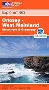
- Landranger Map 006: Orkney - Mainland by Ordnance Survey
- Scotland Touring Map (Collins) by Collins Maps
- Landranger Map 026: Inverness and Loch Ness, Strathglass by Ordnance Survey
- Landranger Map 040: Mallaig and Glenfinnan, Loch Shiel by Ordnance Survey
- Landranger Map 025: Glen Carron and Surrounding Area by Ordnance Survey
- Landranger Map 015: Loch Assynt, Lochinver & Kylesku by Ordnance Survey
- Landranger Map 024: Raasay, Applecross & Loch Torridon by Ordnance Survey
- Landranger Map 035: Kingussie and Monadhliath Mountains by Ordnance Survey
- Landranger Map 034: Fort Augustus, Glen Albyn and Glen Roy by Ordnance Survey
- Landranger Map 018: Sound of Harris & St. Kilda by Ordnance Survey
- Landranger Map 008: Stornoway & North Lewis by Ordnance Survey
- Landranger Map 033: Loch Alsh, Glen Shiel & Loch Hourn by Ordnance Survey
- Landranger Map 005: Orkney - Northern Isles by Ordnance Survey
- Landranger Map 022: Benbecula & South Uist by Ordnance Survey
- Landranger Map 012: Thurso & Wick, John O’Groats by Ordnance Survey
- Landranger Map 020: Beinn Dearg and Loch Broom, Ben Wyvis by Ordnance Survey
Related Tags
"Far Friends"
MDS classes with significant recommendations overlap, excluding ones under the same top-level class.
None
Wording
| 1922 Edition |
| Modern Language |
| Emoji |