MDS 912.413
Wording: History & geography Geography & travel Maps and plans of surface of earth and of extraterrestrial worlds Maps of Europe British Isles - UK, Great Britain, Scotland, Ireland Southeastern Scotland
Dewmoji: 🗺️🚂📍🏰??
0 Computer science, information & general works 252,013 ℹ️ | 1 Philosophy & psychology 270,129 🧠 | 2 Religion 681,242 🙏 | 3 Society, government, & culture 1,328,382 👫 | 4 Language 209,883 💬 | 5 Natural sciences & mathematics 431,918 🔬 | 6 Applied science & technology 940,635 💡 | 7 Arts & recreation 1,031,850 🎨 | 8 Literature & rhetoric 1,436,736 📚 | 9 History & geography 837,760 🗺️ |
90 History 36,727 🔙 | 91 Geography & travel 163,376 🚂 | 92 Biographies, Genealogy, Healdry 88,906 👩 | 93 History of ancient world (to ca. 499) 40,802 📜 | 94 History of Europe 209,479 🏰 | 95 History of Asia 53,941 🏯 | 96 History of Africa 17,044 🦁 | 97 History of North America 188,701 🦃 | 98 History of South America 15,750 🍠 | 99 Oceania & Polar Regions 23,034 🗿 |
910 modified standard subdivisions of Geography and travel 26,567 🚂 | 911 Atlases & Maps 1,908 🔙 | 912 Maps and plans of surface of earth and of extraterrestrial worlds 12,709 📍 | 913 Travel to Specific Places 3,456 📜 | 914 Geography of and travel in Europe 48,846 🏰 | 915 Geography of and travel in Asia 12,863 🗻 | 916 Geography of and travel in Africa 5,587 🦁 | 917 Geography of and travel in North America 37,862 🌽 | 918 Geography of and travel in South America 2,826 🍠 | 919 Geography of and travel in Australasia, Pacific Ocean islands, Atlantic Ocean islands, Arctic islands, Antarctica and on extraterrestrial worlds 10,752 🗿 |
912.0 modified standard subdivisions 550 | 912.1 Maps of Areas, regions, places in general 456 🔙 | 912.2 [not used] 62 🗺 | 912.3 Maps of Ancient world 57 📜 | 912.4 Maps of Europe 3,830 🏰 | 912.5 Maps of Asia 494 🗻 | 912.6 Maps of Africa 186 🦁 | 912.7 Maps of North America 2,152 🌽 | 912.8 Maps of South America 77 🍠 | 912.9 Australasisa, Pacific Ocean Islands, Atlantic Ocean Islands, Arctic Islands, Antarctica, extraterrestrial worlds 530 🗿 |
912.40 3 | 912.41 British Isles - UK, Great Britain, Scotland, Ireland 929 | 912.42 England & Wales 1,269 | 912.43 Germany and central Europe 303 | 912.44 France 188 | 912.45 Italy, San Marino, Vatican City, Malta 213 | 912.46 Spain, Andorra, Gibraltar, Portugal 147 | 912.47 Russia and neighbouring east European countries 58 | 912.48 Scandinavia 202 | 912.49 Other European Countries 249 |
912.410 Standard subdivisions 4 | 912.411 Scotland 167 | 912.412 Northeastern Scotland 51 | 912.413 Southeastern Scotland 50 | 912.414 Southwestern Scotland 99 | 912.415 Ireland 68 | 912.416 Northern Ireland; Donegal County, Monaghan County, Cavan County of Republic of Ireland 30 | 912.417 Republic of Ireland (Eire) 43 | 912.418 Leinster 36 | 912.419 Munster 9 |
912.4130 | 912.4131 Central Region 2 | 912.4132 | 912.4133 | 912.4134 City of Edinburgh 20 | 912.4135 Midlothian 2 | 912.4136 East Lothian 5 | 912.4137 Borders Region 7 | 912.4138 | 912.4139 Eastern districts of Borders Region 1 |
Selected Works under MDS 912.413 (50)
47 items


![Streetfinder Edinburgh [2002] : atlas](https://ecx.images-amazon.com/images/P/0007128045.01._SX100_SY200_SCRM_.jpg)
![Streetfinder Edinburgh [1995] : colour atlas](https://ecx.images-amazon.com/images/P/0702827142.01._SX100_SY200_SCRM_.jpg)


![Streetfinder Edinburgh [1992] : colour atlas](https://pics.cdn.librarything.com/picsizes/51/58/5158925-c-h200-w100-pv25_597732345467426b414d6741_v5.jpg)


![Streetfinder Edinburgh [1995] : colour map](https://pics.cdn.librarything.com/picsizes/46/48/4648194-c-h200-w100-pv25_59774c745267426b414d6741_v5.jpg)


![Streetfinder Edinburgh [1995] : atlas](https://ecx.images-amazon.com/images/P/0702827053.01._SX100_SY200_SCRM_.jpg)


- A-Z Edinburgh Street Atlas by Geographers' A–Z Map Company Limited
- Landranger Map 074: Kelso & surrounding area by Ordnance Survey
- Landranger Map 073: Peebles, Galashiels & surrounding area by Ordnance Survey
- Landranger Map 067: Duns, Dunbar and Eyemouth Area by Ordnance Survey
- Road travel map 3 : Southern Scotland & Northumberland by Ordnance Survey
- Explorer Map 344: Pentland Hills: Penicuik and West Linton by Ordnance Survey
- Edinburgh Street Guide by John Bartholomew and Son
- Explorer Map 350: Edinburgh, Musselburgh & Queensferry by Ordnance Survey
- Explorer Map 338: Galashiels, Selkirk and Melrose, St Boswell's and Lauder by Ordnance Survey
- Explorer Map 366: Stirling & Ochil Hills West by Ordnance Survey
- Explorer Map 365: The Trossachs by Ordnance Survey
- Explorer Map 349: Falkirk, Cumbernauld & Livingston, Linlithgow, Bathgate & Kilsyth by Ordnance Survey
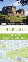
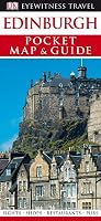
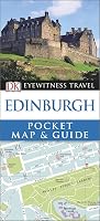
- DK Eyewitness Travel : Pocket Map & Guide : Edinburgh : 2007 by Dorling Kindersley
- Explorer Map 351: Dunbar and North Berwick by Ordnance Survey
- Explorer Map 337: Peebles & Innerleithen, Eddleston & Ettrickbridge, Traquair & Yarrow by Ordnance Survey
- Streetfinder Edinburgh [2002] : atlas by Collins Bartholomew
- DK Eyewitness Travel : Pocket Map & Guide : Edinburgh : 2017 by Edinburgh Pocket Map And Guide -
- Streetfinder Edinburgh [1995] : colour atlas by Bartholomew
- Explorer Map 345: Lammermuir Hills by Ordnance Survey
- John Muir Way by Sandra Bardwell
Related Tags
"Far Friends"
MDS classes with significant recommendations overlap, excluding ones under the same top-level class.
None
Wording
| 1922 Edition |
| Modern Language |
| Emoji |