MDS 912.78
Wording: History & geography Geography & travel Maps and plans of surface of earth and of extraterrestrial worlds Maps of North America Western U.S.
Dewmoji: 🗺️🚂📍🌽🤠
0 Computer science, information & general works 252,013 ℹ️ | 1 Philosophy & psychology 270,129 🧠 | 2 Religion 681,242 🙏 | 3 Society, government, & culture 1,328,382 👫 | 4 Language 209,883 💬 | 5 Natural sciences & mathematics 431,918 🔬 | 6 Applied science & technology 940,635 💡 | 7 Arts & recreation 1,031,850 🎨 | 8 Literature & rhetoric 1,436,736 📚 | 9 History & geography 837,760 🗺️ |
90 History 36,727 🔙 | 91 Geography & travel 163,376 🚂 | 92 Biographies, Genealogy, Healdry 88,906 👩 | 93 History of ancient world (to ca. 499) 40,802 📜 | 94 History of Europe 209,479 🏰 | 95 History of Asia 53,941 🏯 | 96 History of Africa 17,044 🦁 | 97 History of North America 188,701 🦃 | 98 History of South America 15,750 🍠 | 99 Oceania & Polar Regions 23,034 🗿 |
910 modified standard subdivisions of Geography and travel 26,567 🚂 | 911 Atlases & Maps 1,908 🔙 | 912 Maps and plans of surface of earth and of extraterrestrial worlds 12,709 📍 | 913 Travel to Specific Places 3,456 📜 | 914 Geography of and travel in Europe 48,846 🏰 | 915 Geography of and travel in Asia 12,863 🗻 | 916 Geography of and travel in Africa 5,587 🦁 | 917 Geography of and travel in North America 37,862 🌽 | 918 Geography of and travel in South America 2,826 🍠 | 919 Geography of and travel in Australasia, Pacific Ocean islands, Atlantic Ocean islands, Arctic islands, Antarctica and on extraterrestrial worlds 10,752 🗿 |
912.0 modified standard subdivisions 550 | 912.1 Maps of Areas, regions, places in general 456 🔙 | 912.2 [not used] 62 🗺 | 912.3 Maps of Ancient world 57 📜 | 912.4 Maps of Europe 3,830 🏰 | 912.5 Maps of Asia 494 🗻 | 912.6 Maps of Africa 186 🦁 | 912.7 Maps of North America 2,152 🌽 | 912.8 Maps of South America 77 🍠 | 912.9 Australasisa, Pacific Ocean Islands, Atlantic Ocean Islands, Arctic Islands, Antarctica, extraterrestrial worlds 530 🗿 |
912.70 2 | 912.71 Canada 184 🇨🇦 | 912.72 Mexico, Central America, And The Caribbean 88 | 912.73 United States 257 🇺🇸 | 912.74 Northeastern U.S. 314 🗽 | 912.75 Southeastern U.S. 176 🌴 | 912.76 South Central U.S. 122 ⚜ | 912.77 Midwestern U.S. 300 🌽 | 912.78 Western U.S. 95 🤠 | 912.79 West Coast U.S. 329 🏄 |
912.780 | 912.781 Kansas 5 ⏬ | 912.782 5 | 912.783 3 | 912.784 North Dakota 5 ⏫ | 912.785 | 912.786 Montana 3 ⛰ | 912.787 Wyoming 6 🌄 | 912.788 Colorado 22 🏔 | 912.789 New Mexico 14 🏜 |
Selected Works under MDS 912.78 (95)
92 items


![Close-Up USA: The North Central States - 1974 [map]](https://pics.cdn.librarything.com/picsizes/11/36/11367377-b-h200-w100-pv25_5974467a7251426b414d6741_v5.jpg)


![Commerce city quadrangle, Colorado, 1965 (photorevised 1980) 7.5 min series (topographic) [map] [digitized]](https://pics.cdn.librarything.com/picsizes/58/56/5856155-c-h200-w100-pv25_593574625751426b414d6741_v5.jpg)


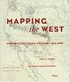
- Mapping the West: America's Westward Movement 1524-1890 by Paul Cohen
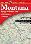
- Montana Atlas & Gazetteer by DeLorme Publishing
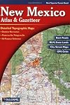
- New Mexico Atlas & Gazetteer by DeLorme Publishing
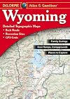
- Wyoming Atlas & Gazetteer by DeLorme Publishing
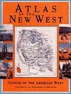
- Atlas of the New West: Portrait of a Changing Region by James J. Robb
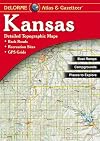
- Kansas Atlas & Gazetteer by DeLorme Publishing
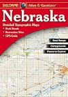
- Nebraska Atlas & Gazetteer by DeLorme Publishing
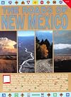
- New Mexico in Maps by Jerry L. Williams
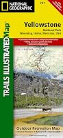
- Yellowstone National Park (Trails Illustrated Map) by Trails Illustrated
- Lewis and Clark Trail Maps: A Cartographic Reconstruction, Volume I by Martin Plamondon
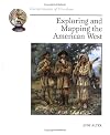
- Exploring and Mapping the American West (Cornerstones of Freedom Second Series) by Judy Alter
- Grand Teton National Park, Wyoming (Trails Illustrated Map) by National Geographic Maps
- Atlas of the Great Plains by Stephen J. Lavin
- Lewis and Clark Trail Maps: A Cartographic Reconstruction, Volume II by Martin Plamondon
- Mapping the Transmississippi West, 1540-1861 by Carl I. Wheat
- Maps of the Santa Fe Trail by Gregory M. Franzwa
- The roads of New Mexico by William H. Burdett
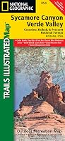
- Sycamore Canyon, Verde Valley (Trails Illustrated Map) by National Geographic Magazine
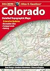
- DeLorme Atlas & Gazetteer: Colorado (Colorado Atlas and Gazetteer) by DeLorme Publishing
- Drive America: Road Atlas Western States by Carroll C. Calkins
Related Tags
"Far Friends"
MDS classes with significant recommendations overlap, excluding ones under the same top-level class.
None
Wording
| 1922 Edition |
| Modern Language |
| Emoji |