Epic Wanderer: David Thompson and the Mapping of the Canadian West
by D'Arcy Jenish
On This Page
Description
Epic Wanderer, the first full-length biography of mapmaker David Thompson (1770-1857), is set in the late eighteenth and early nineteenth centuries against the broad canvas of dramatic rivalries between the United States and British North America, between the Hudson's Bay Company and its Montreal-based rival, the North West Company, and among the various First Nations thrown into disarray by the advent of guns, horses, and alcohol. Less celebrated than his contemporaries Meriwether Lewis and show more William Clark, Thompson spent nearly three decades, beginning in 1784, surveying and mapping more than 1.2 million square miles of largely uncharted Indian territory. Traveling across the prairies, over the Rockies, and on to the Pacific, Thompson transformed the raw data of his explorations into a map of the Canadian West. Measuring ten feet by seven feet and exhibiting astonishing accuracy, the map became essential to the politicians and diplomats who would decide the future of the rich and promising lands of the West. Yet its creator worked without personal glory and died in penniless obscurity. Drawing extensively on Thompson's personal journals and illustrated with his detailed sketches, intricate notebook pages, and the map itself, Epic Wanderer charts the life of a man who risked everything in the name of scientific advancement and exploration. show lessTags
Recommendations


Member Recommendations
47degreesnorth Detailed tale of courage and determination on par with the explorations of Lewis and Clark many years before they ventured into the great unknown

Member Reviews
David Thompson was one of history’s great explorers and cartographers. He was an intelligent, loyal, generous, pious, and sober man. He traveled 50,000 miles through the Canadian wilderness during his 28 years as a fur trader and surveyed and mapped 1.2 million square miles.
His virtues would not be rewarded.
Thompson is hardly an obscure figure, but coverage of his life tends to fade after 1812 when he left the fur trade. Jenish claims this is the first book to cover Thompson’s complete life and its long, sad slide into poverty and obscurity that ended with Thompson’s death in 1857, and it draws heavily from Thompson’s journals.
Thompson certainly never intended to go to Canada and become a fur trader. If he would have had his show more way, he would have stayed in his beloved London. But Thompson’s father had died, and David, born in 1770, was enrolled in the charitable Grey Coat School at age seven. So, in 1784 when a Hudson Bay Company recruiter showed up looking for literate boys with good penmanship, Thompson could hardly refuse the offer to be an apprentice clerk.
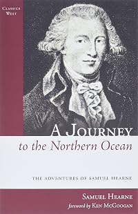
Thus the fourteen-year-old Thompson found himself exiled from England forever and shivering within the ice-covered wooden walls of Fort Churchill on the frozen sea of Hudson’s Bay. (The French navy had destroyed the earlier stone fort in 1782.) There was little business for him to learn. A smallpox epidemic had greatly reduced the local Indian population three years ago, and trade still hadn’t recovered. The fort’s governor, Samuel Hearne, was a thorough going atheist who declared Voltaire to be all he needed by way of religion, so other company officers picked up the slack by way of holding the weekly services attended by the Presbyterian Thompson. Hearne had been instructed to keep the clerk away from the usual contingent of illiterate Orkney Islanders who served as laborers at the post.
But there were books there, and Thompson kept his hand in practice by copying a manuscript Hearne was working on. A Journey from Prince of Wales’s Fort In Hudson’s Bay to the Northern Ocean was an account of Hearne’s three Arctic expeditions as well as ethnographical observations on the local Indians and some of their history. From it, Thompson had his first inkling of the human and geographical complexities of his new home.
In 1785, Thompson found himself reassigned to Fort York, another company post on Hudson Bay. The journey there would start Thompson’s education in traveling through the Arctic wilderness, hunting, and working with native guides.
Thompson’s boss there, Humphrey Marten, was a cranky man at the end of a long career, in poor health, and with no interest in training yet another company clerk. So, after spending an unusually brutal winter at Fort York and doing some hunting, Thompson found himself reassigned again in 1786.
At this point in the Canadian fur trade, the Hudson Bay Company found its staid trade model – build a fort on Hudson Bay and wait for the Indians to come – obsolete. Aggressive traders out of Montreal were moving into the wilderness and taking the trade to the Indians. The Hudson Bay men would have to follow.
Thus, Thompson found himself on a trek to establish a new post on the Saskatchewan River. Its manager was a capable trader, but illiterate, and needed a clerk for what would be South Branch House. In the next three years, Thompson would travel thousands of miles and to the foothills of the Rockies. He would meet and come to appreciate voyageurs and the qualities of the Orkney men HBC would frequently employ. Thompson would pick up a knowledge of French, Cree, and Blackfoot tongues and learn the business and diplomacy skills a successful trader needed.
There were a couple of memorable episodes from this period.
Wintering at Cumberland House, Thompson found himself very bored. There was nothing to read there, not even a Bible. The only recreation was a single checkerboard, and Thompson couldn’t even find someone to play with so played against himself.
But, one day, Thompson did have an opponent: the devil himself, with the “features and color” of a Spaniard no less. The devil lost every game and eventually went away, but Thompson vowed never to “play a game of chance, or skill or anything that had the appearance of them” again.
A decidedly less mystic episode occurred when Thompson, who had impressed his company supervisors, was sent with five other men to winter among the Piegan Indians. Thompson spent the winter with a very old chief, Saukamappee, and learned the Blackfoot language (the process was aided by the chief’s native tongue being Cree) and heard many tales of Piegan life.
Thompson’s life took a significant turn in December 1788 when he fell and snapped the thigh bone of his right leg. And, convalescing at Cumberland House, Thompson met Philip Turnor in October of 1789.
Turnor was the Hudson Bay Company’s first inland surveyor, and the nineteen-year-old Thompson became fascinated by his work. After performing his duties during the day, he would go out into the cold night to assist Turnor and learn how to use the sextant, compass, telescope, watches, and thermometers necessary for surveying. Turnor was impressed by Thompson’s intelligence, enthusiasm, and attention to detail. Turnor was planning an expedition north to chart new territory, and Thompson hoped to go with him.
But, whatever Thompson’s admirable qualities of character and intelligence were, Turnor didn’t think Thompson was physically up to the trip. It wasn’t just Thompson’s leg. His right eye had developed an infection which hampered his vision.
But, while he hadn’t taken Thompson along, Turnor did write the board of directors in 1790 noting Thompson’s ability and that, if his health recovered, Thompson could be relied on to perform any surveying duties required and, if it didn’t, he could certainly teach others to be surveyors.
Coincidentally, Thompson’s term as an unpaid apprentice was up in 1790, and he wrote the board that, in lieu of the traditional payment of clothing, that he be sent some surveying instruments.
Impressed by these two letters, the company replied in 1791. It gave Thompson, now back working as a clerk at York Factory, a three-year contract as well as surveying instruments which they hoped he would be put to good use in “necessary Discoveries inland”.
During the next six years, Thompson would undertake many trips including charting the area around Lake Athabasca, and suffer starvation and illness at times.
The process of charting the numerous rivers was to kneel in the front of a canoe with a compass, stopwatch, and notebook. Estimating the speed of the river, Thompson would take a compass heading and time how long before the river changed direction and note it. The process would be repeated every time the river changed direction.
During those times, despite his remit, Thompson would become disenchanted with his employer. Yes, they had made him a surveyor, but he often had trouble getting logistical support for his expeditions. At the same time, he was also coming in contact with many other traders. Some were with the North West Company, the aggressive competitors of the Hudson Bay Company. At the end of his second three-year contract, Thompson threw in his lot with the North West men in 1797.
The years 1796 and 1797 were active years for Thompson. He traveled 4,000 miles including a trip to the Missouri River to visit the Mandan. That was part of a project by his new employers to find the source of the Mississippi and follow the 49th parallel from the Lake of the Woods to at least the Red River.
September 1798 saw another pivotal event in Thompson’s life. Passing through a company post at Isle a la Crosse on the Churchill River, Thompson met a Cree woman, the wife of a fur trader named Patrick Small, and her three children, including thirteen-year-old Charlotte. Small had made a fortune as a trader and retired to London. In an all-too-common pattern, he had simply abandoned his country wife and his children. Thompson only spent a day at the post, but Charlotte made an impression on him and vice versa.
In June of the next year, Thompson married Charlotte according to Cree custom. They would remain married until Thompson died and have 13 children together. When Thompson retired as a trader and moved to Montreal, the marital vows would be formalized in the Presbyterian church, and Charlotte and children would often accompany Thompson on his expeditions.
In the years 1807 through 1810, Thompson became involved with the North West Company’s push west of the Rockies and to find the source of the Columbia River.
And, of course, this is where the Astoria affair enters the story, and Thompson becomes a figure of disdain for some Canadian historians. The North West Company was certainly aware of Astor’s plans. After all, it was in merger negotiations with Astor. Thompson set out for the Columbia River and the Pacific Coast in 1810. Some Canadians essentially blame Thompson for dallying on the trip, arriving at the Pacific after Astor’s expedition, and, in effect, losing for British Canada what would become the state of Oregon.
Compounding matters is a mysterious gap in Thompson’s journal in October 1810, a gap of about four weeks. Essentially, there are two claims. He undertook a costly detour to avoid increasing tensions with the Blackfoot tribe which was showing some hostility to traders. Or, alternately, Thompson embarrassingly got lost for the first time in his career.
By 1812, Thompson was 41 years old and had spent 28 years as a trader and away from the comforts of civilization. There were a few other men who had led transcontinental expeditions, but none had traveled as many miles in their career as him. Thompson was ready to call it quits.
Thompson was asked to draw a vast map summarizing his trips. The “Map of the North-West Territory of the Province of Canada” was six feet, nine inches by ten feet, four inches and placed in the dining hall at Fort William. There, on the western shores of Lake Superior, the North West men could gaze on their empire during their annual rendezvous.
And here the book’s one glaring defect must be noted: its maps. Oh, we get, in the end papers, a reproduction of that map, and, at various points, smaller sections of it relevant to a particular point in the story. But Thompson’s movements aren’t noted, and the scale of reproduction and amount of Thompson’s detail render them almost useless.
Jenish dramatically tells Thompson’s story with dramatic foreshadowing and that includes the second phase of Thompson’s life.
In 1815, the Thompsons moved to Williamstown, Ontario, and he became involved in another surveying project: the US-Canadian border. The War of 1812 ended with the Treaty of Ghent which stipulated the border be surveyed, and Thompson became part of an international commission to plot the border. The treaty had various articles for the boundary determination, and Thompson’s part was laying out the 1,700 mile section from St. Regis to the Lake of the Woods.
The project would last until 1827 and involve numerous controversies. Each country would find themselves deprived of places they thought they owned, the boundary through the St. Lawrence Seaway would have to be adjusted to avoid splitting islands and to provide a navigable channel to both parties. The final dispute, which overruled Thompson’s work, involved the boundary through the Lake of the Woods. A friend of Thompson described how, each Sunday, Thompson would read, sometimes in French, devotional Bible verses to his crew when he was in the field
Thompson acquired a farm, set up two potash manufacturing facilities, sold firewood, and generously lent out a lot of money to settlers flocking into the Williamstown area.
But things started to fall apart in 1830. A disastrous accident lost him the firewood he had cut on a contract for the military, and he had to buy replacements to honor the contract.
The early 1830s were economically depressed in both Canada and America. Many of the settlers Thompson loaned money to simply left without paying him, a behavior the honorable Thompson was at a loss to understand. One night in January 1833, he examined his books and concluded he was a ruined man.
And, indeed, he was. The remainder of his life would see Thompson and his wife impoverished, their belongings repossessed in bankruptcy, and often supported by their children and in-laws.
He was never able to make much money off his cartographic masterpiece. Because of royal connections, the Hudson Bay Company would often share its maps with Arrowsmith, a London map publisher. The North West Company had no such interest in sharing valuable geographic data, but, when it merged with the Hudson Bay Company, Thompson’s maps came to the attention of Arrowsmith, but he received little compensation for them.
Thompson picked up some surveying jobs he did with his sons. He was bedridden at times due to arthritis in his left leg.
Thinking that, with new efforts to partition Oregon Territory between the two countries, his maps might be politically useful for British claims, Thompson tried to sell them. The notoriously tight-fisted director of the Hudson Bay Company, George Simpson, of course refused, and, so did the British government. Private publishers weren’t interested. In desperation, he even tried to sell information to the American government. Thompson even ended up selling his surveying instruments.
Nothing worked. Maybe there was another way. There were a lot of new books on “voyages and travel” being published. And he had one of the greatest such stories to tell. So, in October 1845, he started writing his memoir. Slowed by lack of lamp oil, and his bad eyesight and ill health, he plugged away. Something happened for about a year, and, for some unknown reason, Thompson did no writing.
When he picked up again, he wanted to show what Canada had lost when it ceded Oregon to the US in 1846.
By January 1848, it was too cold in his rooms to write. And, in February, he lost his sight. He had long had impaired vision in his right eye. Now his left one had a cataract. There is an interesting and detailed account of a treatment Thompson underwent for three months which cleared up the cataracts in both eyes, and he was back writing in May.
At age 78, things were looking up. His debts were paid or forgiven. He was living with one of his daughter’s family and could write to his children. He even wrote some newspaper stories on his adventures.
But 1849 saw the Thompsons move into another daughter’s home and David sickening with cholera. Sometime after 1838, Thompson became estranged from his oldest son. In the winter of 1851, the paper trail ends because Thompson stopped keeping a journal. His last years seem to have been spent reading the Bible and newspapers, being visited by his pastor, and often spending the night outside looking at the stars with Charlotte.
His death was noted by a brief obituary and Charlotte died three months later.
But Jenish doesn’t end the story there.
In 1883, Joseph Burr Tyrell, a member of the Geological Survey of Canada, was doing survey work. Each winter, he went back to Ottawa to present his findings and compare his survey results with existing maps. He was surprised how accurate the old maps were and found they were all done by a David Thompson. What follows is a complicated story about how Tyrrell obtained Thompson’s unpublished journal and tried to publish it himself. Eventually, David Thompson’s Narrative of his Explorations in Western America was published – to no fanfare – in 1916.
While Tyrell says Thompson led a blameless life, some historians wanted to “knock Thompson off his pedestal”. (One of the famous stories around Thompson was his refusal to trade alcohol with the Indians. When ordered to, he simply lashed – badly – the barrels to a horse, and they ended up dashed against a rock. He was not asked to take any more liquor.)
In their account, Thompson was cantankerous, dishonest, and senile when he wrote his narrative.
Jenish convincingly argues otherwise. Thompson was in control of his faculties when he wrote his account. There are, possibly, some blots in Thompson’s life. He is said to have nearly broken a hand beating a Kootenay Indian on one trip. To which I would say that, in the wilderness, physical aggression to maintain discipline and accomplish goals was hardly unheard of among fur traders. Perhaps he took up with an Indian woman, had a child by her, and abandoned them before he met Charlotte. If so, he certainly seems to have made up for it in his life with Charlotte. However cranky Thompson may have been, it certainly doesn’t seem to have bothered the many English clerks and voyageurs who loyally followed him “through many years and thousands of miles”.
Against those charges, Jenish lists Thompson’s accomplishments and not just in surveying and linguistic ability. Thompson could build houses, make canoes, and repair guns. On none of his expeditions did he lose a man.
While I think that Jenish oversells by a bit the conclusion that Thompson’s map embodied the development of Canada and was the “first movement in a symphonic series of events that culminated in Canadian control” from the Atlantic to the Pacific, I did find this the most moving biography I’ve ever read.
The tragedy and grandeur of his life stands apart from the violence and sometime moral squalor of the spies, commanders, and gunfighters I usually read about. show less
His virtues would not be rewarded.
Thompson is hardly an obscure figure, but coverage of his life tends to fade after 1812 when he left the fur trade. Jenish claims this is the first book to cover Thompson’s complete life and its long, sad slide into poverty and obscurity that ended with Thompson’s death in 1857, and it draws heavily from Thompson’s journals.
Thompson certainly never intended to go to Canada and become a fur trader. If he would have had his show more way, he would have stayed in his beloved London. But Thompson’s father had died, and David, born in 1770, was enrolled in the charitable Grey Coat School at age seven. So, in 1784 when a Hudson Bay Company recruiter showed up looking for literate boys with good penmanship, Thompson could hardly refuse the offer to be an apprentice clerk.
Thus the fourteen-year-old Thompson found himself exiled from England forever and shivering within the ice-covered wooden walls of Fort Churchill on the frozen sea of Hudson’s Bay. (The French navy had destroyed the earlier stone fort in 1782.) There was little business for him to learn. A smallpox epidemic had greatly reduced the local Indian population three years ago, and trade still hadn’t recovered. The fort’s governor, Samuel Hearne, was a thorough going atheist who declared Voltaire to be all he needed by way of religion, so other company officers picked up the slack by way of holding the weekly services attended by the Presbyterian Thompson. Hearne had been instructed to keep the clerk away from the usual contingent of illiterate Orkney Islanders who served as laborers at the post.
But there were books there, and Thompson kept his hand in practice by copying a manuscript Hearne was working on. A Journey from Prince of Wales’s Fort In Hudson’s Bay to the Northern Ocean was an account of Hearne’s three Arctic expeditions as well as ethnographical observations on the local Indians and some of their history. From it, Thompson had his first inkling of the human and geographical complexities of his new home.
In 1785, Thompson found himself reassigned to Fort York, another company post on Hudson Bay. The journey there would start Thompson’s education in traveling through the Arctic wilderness, hunting, and working with native guides.
Thompson’s boss there, Humphrey Marten, was a cranky man at the end of a long career, in poor health, and with no interest in training yet another company clerk. So, after spending an unusually brutal winter at Fort York and doing some hunting, Thompson found himself reassigned again in 1786.
At this point in the Canadian fur trade, the Hudson Bay Company found its staid trade model – build a fort on Hudson Bay and wait for the Indians to come – obsolete. Aggressive traders out of Montreal were moving into the wilderness and taking the trade to the Indians. The Hudson Bay men would have to follow.
Thus, Thompson found himself on a trek to establish a new post on the Saskatchewan River. Its manager was a capable trader, but illiterate, and needed a clerk for what would be South Branch House. In the next three years, Thompson would travel thousands of miles and to the foothills of the Rockies. He would meet and come to appreciate voyageurs and the qualities of the Orkney men HBC would frequently employ. Thompson would pick up a knowledge of French, Cree, and Blackfoot tongues and learn the business and diplomacy skills a successful trader needed.
There were a couple of memorable episodes from this period.
Wintering at Cumberland House, Thompson found himself very bored. There was nothing to read there, not even a Bible. The only recreation was a single checkerboard, and Thompson couldn’t even find someone to play with so played against himself.
But, one day, Thompson did have an opponent: the devil himself, with the “features and color” of a Spaniard no less. The devil lost every game and eventually went away, but Thompson vowed never to “play a game of chance, or skill or anything that had the appearance of them” again.
A decidedly less mystic episode occurred when Thompson, who had impressed his company supervisors, was sent with five other men to winter among the Piegan Indians. Thompson spent the winter with a very old chief, Saukamappee, and learned the Blackfoot language (the process was aided by the chief’s native tongue being Cree) and heard many tales of Piegan life.
Thompson’s life took a significant turn in December 1788 when he fell and snapped the thigh bone of his right leg. And, convalescing at Cumberland House, Thompson met Philip Turnor in October of 1789.
Turnor was the Hudson Bay Company’s first inland surveyor, and the nineteen-year-old Thompson became fascinated by his work. After performing his duties during the day, he would go out into the cold night to assist Turnor and learn how to use the sextant, compass, telescope, watches, and thermometers necessary for surveying. Turnor was impressed by Thompson’s intelligence, enthusiasm, and attention to detail. Turnor was planning an expedition north to chart new territory, and Thompson hoped to go with him.
But, whatever Thompson’s admirable qualities of character and intelligence were, Turnor didn’t think Thompson was physically up to the trip. It wasn’t just Thompson’s leg. His right eye had developed an infection which hampered his vision.
But, while he hadn’t taken Thompson along, Turnor did write the board of directors in 1790 noting Thompson’s ability and that, if his health recovered, Thompson could be relied on to perform any surveying duties required and, if it didn’t, he could certainly teach others to be surveyors.
Coincidentally, Thompson’s term as an unpaid apprentice was up in 1790, and he wrote the board that, in lieu of the traditional payment of clothing, that he be sent some surveying instruments.
Impressed by these two letters, the company replied in 1791. It gave Thompson, now back working as a clerk at York Factory, a three-year contract as well as surveying instruments which they hoped he would be put to good use in “necessary Discoveries inland”.
During the next six years, Thompson would undertake many trips including charting the area around Lake Athabasca, and suffer starvation and illness at times.
The process of charting the numerous rivers was to kneel in the front of a canoe with a compass, stopwatch, and notebook. Estimating the speed of the river, Thompson would take a compass heading and time how long before the river changed direction and note it. The process would be repeated every time the river changed direction.
During those times, despite his remit, Thompson would become disenchanted with his employer. Yes, they had made him a surveyor, but he often had trouble getting logistical support for his expeditions. At the same time, he was also coming in contact with many other traders. Some were with the North West Company, the aggressive competitors of the Hudson Bay Company. At the end of his second three-year contract, Thompson threw in his lot with the North West men in 1797.
The years 1796 and 1797 were active years for Thompson. He traveled 4,000 miles including a trip to the Missouri River to visit the Mandan. That was part of a project by his new employers to find the source of the Mississippi and follow the 49th parallel from the Lake of the Woods to at least the Red River.
September 1798 saw another pivotal event in Thompson’s life. Passing through a company post at Isle a la Crosse on the Churchill River, Thompson met a Cree woman, the wife of a fur trader named Patrick Small, and her three children, including thirteen-year-old Charlotte. Small had made a fortune as a trader and retired to London. In an all-too-common pattern, he had simply abandoned his country wife and his children. Thompson only spent a day at the post, but Charlotte made an impression on him and vice versa.
In June of the next year, Thompson married Charlotte according to Cree custom. They would remain married until Thompson died and have 13 children together. When Thompson retired as a trader and moved to Montreal, the marital vows would be formalized in the Presbyterian church, and Charlotte and children would often accompany Thompson on his expeditions.
In the years 1807 through 1810, Thompson became involved with the North West Company’s push west of the Rockies and to find the source of the Columbia River.
And, of course, this is where the Astoria affair enters the story, and Thompson becomes a figure of disdain for some Canadian historians. The North West Company was certainly aware of Astor’s plans. After all, it was in merger negotiations with Astor. Thompson set out for the Columbia River and the Pacific Coast in 1810. Some Canadians essentially blame Thompson for dallying on the trip, arriving at the Pacific after Astor’s expedition, and, in effect, losing for British Canada what would become the state of Oregon.
Compounding matters is a mysterious gap in Thompson’s journal in October 1810, a gap of about four weeks. Essentially, there are two claims. He undertook a costly detour to avoid increasing tensions with the Blackfoot tribe which was showing some hostility to traders. Or, alternately, Thompson embarrassingly got lost for the first time in his career.
By 1812, Thompson was 41 years old and had spent 28 years as a trader and away from the comforts of civilization. There were a few other men who had led transcontinental expeditions, but none had traveled as many miles in their career as him. Thompson was ready to call it quits.
Thompson was asked to draw a vast map summarizing his trips. The “Map of the North-West Territory of the Province of Canada” was six feet, nine inches by ten feet, four inches and placed in the dining hall at Fort William. There, on the western shores of Lake Superior, the North West men could gaze on their empire during their annual rendezvous.
And here the book’s one glaring defect must be noted: its maps. Oh, we get, in the end papers, a reproduction of that map, and, at various points, smaller sections of it relevant to a particular point in the story. But Thompson’s movements aren’t noted, and the scale of reproduction and amount of Thompson’s detail render them almost useless.
Jenish dramatically tells Thompson’s story with dramatic foreshadowing and that includes the second phase of Thompson’s life.
In 1815, the Thompsons moved to Williamstown, Ontario, and he became involved in another surveying project: the US-Canadian border. The War of 1812 ended with the Treaty of Ghent which stipulated the border be surveyed, and Thompson became part of an international commission to plot the border. The treaty had various articles for the boundary determination, and Thompson’s part was laying out the 1,700 mile section from St. Regis to the Lake of the Woods.
The project would last until 1827 and involve numerous controversies. Each country would find themselves deprived of places they thought they owned, the boundary through the St. Lawrence Seaway would have to be adjusted to avoid splitting islands and to provide a navigable channel to both parties. The final dispute, which overruled Thompson’s work, involved the boundary through the Lake of the Woods. A friend of Thompson described how, each Sunday, Thompson would read, sometimes in French, devotional Bible verses to his crew when he was in the field
Thompson acquired a farm, set up two potash manufacturing facilities, sold firewood, and generously lent out a lot of money to settlers flocking into the Williamstown area.
But things started to fall apart in 1830. A disastrous accident lost him the firewood he had cut on a contract for the military, and he had to buy replacements to honor the contract.
The early 1830s were economically depressed in both Canada and America. Many of the settlers Thompson loaned money to simply left without paying him, a behavior the honorable Thompson was at a loss to understand. One night in January 1833, he examined his books and concluded he was a ruined man.
And, indeed, he was. The remainder of his life would see Thompson and his wife impoverished, their belongings repossessed in bankruptcy, and often supported by their children and in-laws.
He was never able to make much money off his cartographic masterpiece. Because of royal connections, the Hudson Bay Company would often share its maps with Arrowsmith, a London map publisher. The North West Company had no such interest in sharing valuable geographic data, but, when it merged with the Hudson Bay Company, Thompson’s maps came to the attention of Arrowsmith, but he received little compensation for them.
Thompson picked up some surveying jobs he did with his sons. He was bedridden at times due to arthritis in his left leg.
Thinking that, with new efforts to partition Oregon Territory between the two countries, his maps might be politically useful for British claims, Thompson tried to sell them. The notoriously tight-fisted director of the Hudson Bay Company, George Simpson, of course refused, and, so did the British government. Private publishers weren’t interested. In desperation, he even tried to sell information to the American government. Thompson even ended up selling his surveying instruments.
Nothing worked. Maybe there was another way. There were a lot of new books on “voyages and travel” being published. And he had one of the greatest such stories to tell. So, in October 1845, he started writing his memoir. Slowed by lack of lamp oil, and his bad eyesight and ill health, he plugged away. Something happened for about a year, and, for some unknown reason, Thompson did no writing.
When he picked up again, he wanted to show what Canada had lost when it ceded Oregon to the US in 1846.
By January 1848, it was too cold in his rooms to write. And, in February, he lost his sight. He had long had impaired vision in his right eye. Now his left one had a cataract. There is an interesting and detailed account of a treatment Thompson underwent for three months which cleared up the cataracts in both eyes, and he was back writing in May.
At age 78, things were looking up. His debts were paid or forgiven. He was living with one of his daughter’s family and could write to his children. He even wrote some newspaper stories on his adventures.
But 1849 saw the Thompsons move into another daughter’s home and David sickening with cholera. Sometime after 1838, Thompson became estranged from his oldest son. In the winter of 1851, the paper trail ends because Thompson stopped keeping a journal. His last years seem to have been spent reading the Bible and newspapers, being visited by his pastor, and often spending the night outside looking at the stars with Charlotte.
His death was noted by a brief obituary and Charlotte died three months later.
But Jenish doesn’t end the story there.
In 1883, Joseph Burr Tyrell, a member of the Geological Survey of Canada, was doing survey work. Each winter, he went back to Ottawa to present his findings and compare his survey results with existing maps. He was surprised how accurate the old maps were and found they were all done by a David Thompson. What follows is a complicated story about how Tyrrell obtained Thompson’s unpublished journal and tried to publish it himself. Eventually, David Thompson’s Narrative of his Explorations in Western America was published – to no fanfare – in 1916.
While Tyrell says Thompson led a blameless life, some historians wanted to “knock Thompson off his pedestal”. (One of the famous stories around Thompson was his refusal to trade alcohol with the Indians. When ordered to, he simply lashed – badly – the barrels to a horse, and they ended up dashed against a rock. He was not asked to take any more liquor.)
In their account, Thompson was cantankerous, dishonest, and senile when he wrote his narrative.
Jenish convincingly argues otherwise. Thompson was in control of his faculties when he wrote his account. There are, possibly, some blots in Thompson’s life. He is said to have nearly broken a hand beating a Kootenay Indian on one trip. To which I would say that, in the wilderness, physical aggression to maintain discipline and accomplish goals was hardly unheard of among fur traders. Perhaps he took up with an Indian woman, had a child by her, and abandoned them before he met Charlotte. If so, he certainly seems to have made up for it in his life with Charlotte. However cranky Thompson may have been, it certainly doesn’t seem to have bothered the many English clerks and voyageurs who loyally followed him “through many years and thousands of miles”.
Against those charges, Jenish lists Thompson’s accomplishments and not just in surveying and linguistic ability. Thompson could build houses, make canoes, and repair guns. On none of his expeditions did he lose a man.
While I think that Jenish oversells by a bit the conclusion that Thompson’s map embodied the development of Canada and was the “first movement in a symphonic series of events that culminated in Canadian control” from the Atlantic to the Pacific, I did find this the most moving biography I’ve ever read.
The tragedy and grandeur of his life stands apart from the violence and sometime moral squalor of the spies, commanders, and gunfighters I usually read about. show less
For a book subtitled "David Thompson and the mapping of the Canadian West", the maps were terrible! Other than that, I enjoyed the book. I found it comprehensive, intriguing and well written. I liked the details about life in the fur trade and the portrayal of Aboriginal people. I think the book also showed the effectiveness of difference industrial models -- the colonialism of the Hudson's Bay Company vs the entrepreneurship of the Northwest traders. I would have liked to know so much more about Thompson's wife, Charlotte.
David Thompson makes Lewis and Clark appear like day hikers. A thoroughly engaging and comprehensive book on his exploits and explorations. Very well written as well. Only improvement could have been in the maps.
Thompson's story makes this well worth reading, but the writing really leaves something to be desired.
Ratings
Members
- Recently Added By
Author Information

8 Works 248 Members
D'Arcy Jenish is the author of The Stanley Cup: 100 Years of Hockey at Its Best and The Montreal Canadiens: 100 Years of Glory, and co-editor of Canada on Ice: Fifty Years of Great Hockey. His other works of history include Epic Wanderer: David Thompson and the Mapping of the Canadian West and Indian Fall: The Last Great Days of the Plains Cree show more and the Blackfoot Confederacy. show less
Common Knowledge
- People/Characters
- David Thompson, explorer
- Important places
- Canada; Pacific Northwest
Classifications
- Genres
- Nonfiction, History, Biography & Memoir, General Nonfiction, Science & Nature
- DDC/MDS
- 526.092 — Natural sciences & mathematics Astronomy Mathematical geography History, geographic treatment, biography Biography
- LCC
- GA473.7 .T48 .J46 — Geography, Anthropology and Recreation Mathematical geography. Cartography Mathematical geography. Cartography Cartography Maps. By region or country
- BISAC
Statistics
- Members
- 104
- Popularity
- 308,233
- Reviews
- 4
- Rating
- (4.00)
- Languages
- English
- Media
- Paper, Ebook
- ISBNs
- 5
- ASINs
- 1