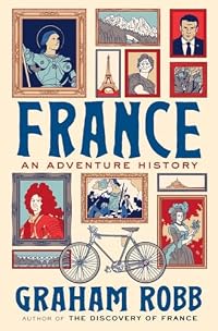
The Discovery of Middle Earth: Mapping the Lost World of the Celts
by Graham Robb
On This Page
Description
Describes a discovery the author made in the Alps, which uncovered a treasure trove of Druid celestial mathematics that mapped out the entire geography of ancient Europe, and discusses the implications of this new information.Tags
Recommendations


Member Reviews
The argument here is that rather than being disorganised, hairy alcoholics (they drank their wine undiluted, a practice to which the whole race appeared addicted) the Celts instead were a religious confederation under the guidance of the Druids. And more importantly, they understood astronomy and geometry (from being descended from the Greeks who built Marseille) and based their civilisation on a sun worship that used their understanding of solstice and meridian lines to place all important sites and settlements, sites which are still in place today.
Its a compelling argument - which begins with the straight as a die Via Heraclea, used by Hannibal in his invasion of Italy, explains some of the inexplicable choices Gaullish leaders made show more in siting their battles (the augury of being on important sun lines) and links British druidery with their cousins on the continent, through a confluence of Meridians running through Glastonbury, Whitchurch and Oxford
Essentially the Druids are presented as surveyors par excellence. And the Gauls as a people with their fate trapped in the sun lines
Its all beautifully argued, wonderfully illustrated, and rather melancholy. The trouble is I have no idea if any of it is true or not. I want it to be - I simply don't know enough Gaulish history to be sure. The sceptic will say that of course its not surprising if the Romans and their successors built on preused, preauspicious sites, even if they dont accept that the famous Roman roads of Britain were built on preexisting meridian and solstice based paths that already existed. But they will argue that Robb is simply making vast conclusions on the basis of a few geometric coincidences. Draw enough straight lines, they will say, and you are bound to find links. But its mainly noise, not signal (sorry, I've been reading Nate Silver)
And I simply don't know. But I enjoyed the book. And I liked the idea of Caratacus, holed up in Dinas Emrys, confident of success because of being on the Whitchurch meridian, but ultimately doomed. I grew up in North Wales and I can't dislodge this image.
It may be too dense, and too obscure for some. And there are a lot of maps with straight lines drawn on them. But I'd recommend it - if nothing else it humanises a race about which history has had little to say show less
I found this book to be slightly maddening. At its heart, I think there are some probable truths....that sacred sites and even cities were located by Celtic or Druid Priests on lines which tallied with solar measurements ....especially the winter and summer equinoxes. But the author goes much further than this and draws all sorts of lines on his (Mercator projection) maps and finds mysterious linkages with all sorts of ancient cities and sacred sites. As he says, towards the last few pages: "geomantic expeditions are not for the neurotically disposed'.....having just plotted on a meridian, the restaurant where he'd had a discussion to the left-luggage office at St Pancreas Station where his bicycle had completed its journey. The whole show more book smacks of a theory in search of coincidences which would confirm the theory. Rather like numerology. I was interested in the map of Britain on p 282 where a large number of early christian sites had been plotted. Over this Robb has plotted a few of his Royal Roads and solstice lines. Yes they pass through a number of the christian sites but there seem to be a huge number that are not related. So what can one conclude from all of this?
Well, first, Graham Robb has put a power of work into his various pathways and plots and has personally ridden many of these routes on his bicycle...especially in France. And for this he has to be given credit. But what I continue to find disturbing, is that he pretty much ignores geography. It's all based on astronomical projections and cities are located not necessarily where nature has located a well endowed site with natural fortifications and access to water but at the intersection of some meridian line (somewhat arbitrarily chosen) and another solstice line that happens to run through another site. Maybe he is right but I wonder about all the other sites that he doesn't mention and wonder whether he is cherry picking his data to suit his theory. A fairer way of doing things might be to come up with a compete listing of all acknowledged sacred sites and see how many of them fell on these astronomically "predictive" lines. If they all fell on the lines then I think he would have a case closed but if he's just cherry picked then he's really proved nothing much.
I have difficulty with his apparent starting point with the route of Herakles...whether you take it from Andorra to the alps or project even further back to the sacred promontory of Sagres in Portugal. His lines look fine when plotted on the modern Mercator projection ...and duly pass through Narbonne and end at the Matrona pass. But they certainly don't do this when plotted on the more accurate Lambert's azimulthal equal area projection of Europe. If you try projecting from Sagres via Andorra you end up far to the south and in the Mediterranean sea. And if you take Andorra as your starting point and project eastwards via Narbonne then you end up far to the north of the alps. So Robb's overly simplistic base lines seem very suspect to me. And even the idea that Druids and Celts had adopted wholesale the legend of Herakles seems rather suspect to me. A big problem with the Druids was that they left no writings so Robb is pretty free to attribute anything to them ....and does. Though he certainly has a much higher opinion of them and their accomplishments than contemporary Roman writers such as Caesar and Polybius.
I found, when I checked, that most of the reviews of the book were very favourable ..."Remarkable...an overarching, wondrous reworking of history" says Phillip Hoare of the Literary Review. In fact, I only found one review which questioned the fairly bold claims made by Robb and the lack of references to back up some of the claims. (Though, to be fair, I think he has done a reasonable job with the references).
Overall, I found it a pretty hard slog to read. And rather repetitive....especially when he runs through the same sort of procedure for Britain (after France) and then Ireland.
I noticed that like many people who are fond of geometrical links (or golden ratios etc.,) that they are prepared to claim somewhat spurious accuracy. For example, his lines superimposed on an image of the roundel on p247, don't exactly line up with the centres of the circles etc., and one could....with this sort of diagram pick any point to draw the lines and it would match some feature (with the various spirals) in the actual figure. I remember seeing some similar geometry being applied to a famous Japanese stone garden in Kyoto......but this time using the golden ratio. Superficially it looked fine but only because a particular group of stones was spread over a fair area and so the line could be made to intersect wherever suited the theory best.
OK. I think there is probably some truth in what Robb is saying. Priests and soothsayers did take astronomical readings and oriented activities according to the sun cycles (Stonehenge and the standing stones all over France and Spain testify to this). And, if a new city or sacred site was to be established presumably the priests would be consulted and use their astronomical observations to predict favourable sites. (Certainly this happened with the location of Mexico City and happens today with houses and shinto rites in Japan). Though, I suspect, the priestly incantations etc were probably overlain with a bit of pragmatic local geography. For me, It's hard to know how much of Robb's tales to believe. My impression is that he is over-claiming and cherry picking but without looking in detail for all the other sacred sites (and there must be tens of thousands) and checking to see if they also align with the royal roads and solstice lines ...it's hard to know for sure. But just looking at the map of France on p58 and that of Britain on p282..it seems to me that local geography is at least as important and many of these sites are clearly NOT located on the meridianal lines or equinox lines.
So an interesting book. It has somewhat intrigued me but still have my doubts about people with theories who want to draw lines on maps to suit their theories and look only for supporting evidence and are happy to accept places that are close but not exactly on the lines. I give it 4 stars. show less
If you’re looking for stories with details on iron age life and the magical acts performed by Druids, you will be disappointed with this book. Graham Robb doesn’t promise what he can’t deliver.
But if you are curious about what we now know about the mythological and practical maps that the Celts used to map Gaul, Britain, and Ireland, he can help you out. And he knows what he’s talking about because he first realized that hints at the Iron Age Celtic world still exist in the landscape of these places today.
Using solar routes, longitude and latitudes, and Celtic myths, Robb draws up places either long disappeared or buried beneath more recent history. Taken together, they provide maps of a world long gone. The Celtic world he has show more discovered is based on myth, yes. But more importantly, it’s based on math, including a geometry different from the Euclidean geometry of the classic world.
While I sometimes found this book difficult to follow, the glimpses I got were fascinating. The ancient Celts weren’t the unsophisticated, hairy brutes the Romans portrayed them to be. They were different, but in their own way, just as intelligent as the Romans who defeated them.
I recommend this book to anyone genuinely curious about ancient Celtic cultures. While they didn’t leave written accounts to satisfy our curiosity, what Graham Robb teases out of the rubble provides a tantalizing peek and much fodder for the imagination. I'd give this book 3.5 stars if I could. It's a good book, though sometimes hard to follow. show less
The author's theory is that the Druids were ancient geocachers who used meridiens, solstice lines, and equinox lines to construct a mental grid mapping Gaul, Iberia, and Britain, which was then used to site oppida, tribal boundaries and battlefields.
He may be on to something and no doubt the pre-Roman Celts were more advanced than they are often given credit for, but I suspect that if you look at enough scattered points and lines on a map you can find a pattern. I admit my eyes glazed over at times so I may have missed something, but the reasoning did seem to be circular at times: the site must have been here because the theory says so and the fact that the site was here shows the theory is right.
He may be on to something and no doubt the pre-Roman Celts were more advanced than they are often given credit for, but I suspect that if you look at enough scattered points and lines on a map you can find a pattern. I admit my eyes glazed over at times so I may have missed something, but the reasoning did seem to be circular at times: the site must have been here because the theory says so and the fact that the site was here shows the theory is right.
This book was a bit of a disappointment to me. I really liked Graham Robb's first two books, but this one didn't seem to be on the same level. I think the problem is that the thesis of the work, that Celts were both so obsessed with winter/summer solstice, and so good at geometry and mapping that they could build their entire civilization along these lines. I have no idea if the author cherry picked his data points to fit his model, but I would like to know if some of towns or other markers were left out.
On the other hand, the book is very well written and entertaining, and does provide a nice introduction to the culture of Gaul before (and during) the Roman occupation. And I do believe that the solstice was a major focus of Celtic show more religion. It's just hard to believe that in the days before the compass and sextants, that this kind of large scale surveying could have been done. show less
On the other hand, the book is very well written and entertaining, and does provide a nice introduction to the culture of Gaul before (and during) the Roman occupation. And I do believe that the solstice was a major focus of Celtic show more religion. It's just hard to believe that in the days before the compass and sextants, that this kind of large scale surveying could have been done. show less
This book is Robb's theory of how the ancient celts organised themselves.
Whilst following the legendary Via Heraklea he concludes that this pre Roman peoples layout of settlements and ritual sites follow a series of solstice lines across Gaul (France). These lines follow a particular angle, from east to west and another angle from west to east. Some of these lines go directly through the centre of these sites, and others pass through at a distance of 1km or so away.
It does have lots of fascinating facts in the book, and some of the details that he brings out as supporting evidence, show that this culture and people were far more sophisticated than was previously though. There is also evidence to suggest that the Romans overlaid their show more roads and towns on some of the features that the celts had developed.
I am not an expert of the ancient celts of Europe, but it doesn't seem really convincing as an argument, and reminds me rather of ley lines, those mysterious links between features and ancient sites that amateur archaeologist Alfred Watkins proposed. As has been demonstrated elsewhere any series of points on a map can be shown to have a link purely down to chance. It is a shame really as I hoped that this would be more than a speculative book, and was going to be more about this fascinating culture. show less
What Graham Robb needs is an independent researcher to verify his hypothesis. I can't determine if he is just being optimistic or if he has found proof of a continental wide pre-Roman, Celtic civilization road system. In any case, this book is interesting and provides a fascinating look at Celtic Europe civilization.
Members
- Recently Added By
Lists

Non-Fiction Worth Reading
1,015 works; 260 members

TBR of Books I Don't Own
132 works; 1 member
Author Information

16+ Works 4,732 Members
Graham Robb's two previous books, "Victor Hugo" & "Balzac," were "New York Times" Notable Books. He lives in Oxford, England. (Bowker Author Biography)
Awards and Honors
Awards
Distinctions
Classifications
Statistics
- Members
- 583
- Popularity
- 49,849
- Reviews
- 16
- Rating
- (2.88)
- Languages
- English, French
- Media
- Paper, Ebook
- ISBNs
- 12
- UPCs
- 1
- ASINs
- 7