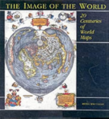
The Image of the World: 20 Centuries of World Maps
by Peter Whitfield
On This Page
Description
Draws on the collection of maps held by the British Library and other major collections to tell the history of mapmaking.Tags
Recommendations


Member Reviews
A history of mapmaking, specifically of world maps. It touches on the technicalities of projections and survey work, but the focus is on the maps as cultural products, analyzing their social rôle and how culture determines what is considered important to show (a lot of attention is paid to the angels, personified winds, historical vignettes, etc, that used to accompany maps, tho, curiously, less to sea serpents and "here be dragons" signs).
As far as hard facts go, it didn't tell me much I didn't already know, and some of the socio-cultural analysis struck me as superficial. That said, the array of splendid reproductions of historical maps makes it more than worth the money I spent on it.
As far as hard facts go, it didn't tell me much I didn't already know, and some of the socio-cultural analysis struck me as superficial. That said, the array of splendid reproductions of historical maps makes it more than worth the money I spent on it.
The Image of the World is a slightly updated edition of Peter Whitfield’s 1994 work. Whitfield, who has published similar, image-laden overviews of cartographic and scientific history, offers a learned and accessible introduction to the story of (primarily Western) cartography from classical times to the present. Laudably, this production is an eye-catching book that also serves to acquaint the lay reader with the notion that maps are not just quaint illustrations, but windows into the world of their creation.
The book is good for survey courses on the history of cartography, but is of little use for in-depth scholarship. Each map is described in detail, but there are no footnotes or reference material for each map; there is a general show more bibliography for further reading, a list of image credits, and a serviceable index. The illustrations are eye-pleasing, though some are too small to offer any detail, and much information is lost in the crease between pages. Still, Whitfield’s The Image of the World is a great introductory to the sweep of cartographic history and admirably does the job of presenting maps as more than geographical tools but cultural productions. show less
The book is good for survey courses on the history of cartography, but is of little use for in-depth scholarship. Each map is described in detail, but there are no footnotes or reference material for each map; there is a general show more bibliography for further reading, a list of image credits, and a serviceable index. The illustrations are eye-pleasing, though some are too small to offer any detail, and much information is lost in the crease between pages. Still, Whitfield’s The Image of the World is a great introductory to the sweep of cartographic history and admirably does the job of presenting maps as more than geographical tools but cultural productions. show less
A review of maps from about 1100 to 1990
Ratings
Members
- Recently Added By
Author Information

25+ Works 1,362 Members
Peter Whitfield is a former director of Stanford's International Map Centre in London.
Common Knowledge
- Original publication date
- 1994
Classifications
- Genres
- Nonfiction, Reference, History, General Nonfiction, Travel, Art & Design
- DDC/MDS
- 912.09 — History & geography Geography & travel Maps and plans of surface of earth and of extraterrestrial worlds modified standard subdivisions History and biography of maps and map making
- LCC
- GA201 .W48 — Geography, Anthropology and Recreation Mathematical geography. Cartography Mathematical geography. Cartography Cartography
- BISAC
Statistics
- Members
- 142
- Popularity
- 231,835
- Reviews
- 3
- Rating
- (3.89)
- Languages
- English
- Media
- Paper
- ISBNs
- 5
- ASINs
- 1