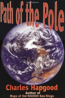
Maps of the Ancient Sea Kings: Evidence of Advanced Civilization in the Ice Age
by Charles H. Hapgood
On This Page
Description
Hapgood utilizes ancient maps as concrete evidence of an advanced worldwide civilization existing many thousands of years before ancient Egypt. Hapgood concluded that these ancient mapmakers were in some ways much more advanced in mapmaking than any people prior to the 18th century. Hapgood believes that they mapped all the continents. This would mean that the Americas were mapped thousands of years before Columbus. Antarctica would have been mapped when its coasts were free of ice. Hapgood show more supposes that there is evidence that these people must have lived when the Ice Age had not yet ended in the Northern Hemisphere and when Alaska was still connected with Siberia by the Pleistocene, Ice Age 'land bridge'. show lessTags
Recommendations


Member Reviews
I don't mind admitting that all the references to spherical trigonometry were beyond me (I'm no mathematician and certainly no cartographer), but I don't think that spoiled the book's overall impression. To me, the reasoning of Professor Hapgood and his students is perfectly sound: the maps in question appear to indicate that at some point prior to recorded history, Earth was host to an advanced civilization which mapped the entire planet, including Antarctica when its coastlines were free of ice.
The curious fact is not that such maps existed for sixteenth-century cartographers like Piri Reis and Oronteus Finaeus (Oronce Fine, if you're looking him up on Wikipedia) to copy, but that the civilization responsible for them had otherwise show more vanished without a trace. There is absolutely no indication of who these people might have been, what they called themselves or from which corner of the globe they emerged. Hapgood does not mention Sumer, the earliest known civilization, but notes that the last time Antarctica's coasts were ice-free was about 6,000 years ago; perhaps not so coincidentally, this is when the Sumerian civilization began under circumstances that remain mysterious even today. (It should be pointed out that the Sumerians, though they did sail on reed boats, were not great seafarers. Hapgood firmly believed that the civilization which mapped our planet at such an early date must have been a worldwide civilization...and the Sumerians, advanced as they were in so many respects, do not fit that description. However, their texts explicitly state that they received their culture from the gods themselves. It's possible that the maps were created not by a terrestrial civilization, but by one from another world.) show less
The curious fact is not that such maps existed for sixteenth-century cartographers like Piri Reis and Oronteus Finaeus (Oronce Fine, if you're looking him up on Wikipedia) to copy, but that the civilization responsible for them had otherwise show more vanished without a trace. There is absolutely no indication of who these people might have been, what they called themselves or from which corner of the globe they emerged. Hapgood does not mention Sumer, the earliest known civilization, but notes that the last time Antarctica's coasts were ice-free was about 6,000 years ago; perhaps not so coincidentally, this is when the Sumerian civilization began under circumstances that remain mysterious even today. (It should be pointed out that the Sumerians, though they did sail on reed boats, were not great seafarers. Hapgood firmly believed that the civilization which mapped our planet at such an early date must have been a worldwide civilization...and the Sumerians, advanced as they were in so many respects, do not fit that description. However, their texts explicitly state that they received their culture from the gods themselves. It's possible that the maps were created not by a terrestrial civilization, but by one from another world.) show less
No serious student of history can miss this book. Hapgood (who was laughed at by the established academic community when this book was published -- in part because he used undergraduates to help in his research - academics can be so closed minded and such assholes!) has raised the bar and broken open the box of antiquated archaeological and geographical thinking and has gone to the myths, legends and the extant artifices that contradicts almost everything that has been written about "pre-history" up to this point. This is a MAJOR WORK by a gifted teacher who came to his conclusions from legitimately being involved in his subject matter.... I am personally very grateful for this work! It opens doors (and hopefully minds) to a new world show more of advanced civilizations that appeared (and disappeared) long before out 5000 year old timeline began. show less
A fascinating book that could use an even larger format & color photographs to make it perfect.
MAPS OF THE ANCIENT SEA KINGS:EVIDENCE OF ADVANCED CIVILIZATION IN THE ICE AGE
While searching for the earliest map of Antarctica, I heard about the Piri Reis Map of 1513 and the Oronce Fine (Oronteus Finaeus) Map of 1531. And in due course came across this book. I had my reservations, based on some of the info I had read, about Hapgood (as well as the Map librarian at LOC telling me he was a nut), but I feel that in this book he makes an interesting case for his hypothesis of an early seafaring/map making culture(s). Many of his theories about the maps he and his students examined are backed up by other experts and even military cartographers. Yet after digesting what I'd read a little more and reading "The Piri Reis Map of 1513" by show more Gregory C. McIntosh [see my review], Hapgood makes a number of assumptions and, at times, disregards or distorts evidence in order to better make his case. I think my lack of prior knowledge in this area made it more believable. Also, even though this book contains a lot of cartographic and mathematical descriptions, it is still quite readable for the average person. Finally, this edition (1966) could have had better (in color and sharper) pictures of the maps. show less
While searching for the earliest map of Antarctica, I heard about the Piri Reis Map of 1513 and the Oronce Fine (Oronteus Finaeus) Map of 1531. And in due course came across this book. I had my reservations, based on some of the info I had read, about Hapgood (as well as the Map librarian at LOC telling me he was a nut), but I feel that in this book he makes an interesting case for his hypothesis of an early seafaring/map making culture(s). Many of his theories about the maps he and his students examined are backed up by other experts and even military cartographers. Yet after digesting what I'd read a little more and reading "The Piri Reis Map of 1513" by show more Gregory C. McIntosh [see my review], Hapgood makes a number of assumptions and, at times, disregards or distorts evidence in order to better make his case. I think my lack of prior knowledge in this area made it more believable. Also, even though this book contains a lot of cartographic and mathematical descriptions, it is still quite readable for the average person. Finally, this edition (1966) could have had better (in color and sharper) pictures of the maps. show less
Jan 2, 2018 (Edited)Spanish
Ratings
Members
- Recently Added By
Lists

Non-fiction that you shouldn't waste your time on
45 works; 15 members
Author Information
11 Works 524 Members
Common Knowledge
- Dedication
- A Word of Appreciation
Discoveries are often made by persons who, having fastened onto suggestions made by others, follow them through. This is the case with this book, which is the result of seven years of inte... (show all)nsive research undertaken as the result of a suggestion made by someone else.
That person is Captain Arlington H. Mallery. He first suggested that the Piri Re'is Map, brought to light in 1929 but drawn in 1513 and based upon much older maps, showed a part of Antartica. It was he who made the original suggestion that the first map of this coast must have been drawn before the present immense Antarctic ice cap had covered the coasts of Queen Maud Land. His sensational suggestion was the inspiration for our research.
It is therefore with deep appreciation that I dedicate this book to Captain Arlington H. Mallery. - First words
- In 1929, in the old Imperial Palace in Constantinople, a map was found that caused great excitement.
- Last words
- (Click to show. Warning: May contain spoilers.)We have manifold leads, which further research can hardly fail to develop.
Classifications
- Genres
- Anthropology, History, Nonfiction, Reference, General Nonfiction, Travel
- DDC/MDS
- 912.09 — History & geography Geography & travel Maps and plans of surface of earth and of extraterrestrial worlds modified standard subdivisions History and biography of maps and map making
- LCC
- GA300 .H3 — Geography, Anthropology and Recreation Mathematical geography. Cartography Mathematical geography. Cartography Cartography World maps, general atlases, etc.
- BISAC
Statistics
- Members
- 396
- Popularity
- 78,658
- Reviews
- 5
- Rating
- (3.87)
- Languages
- English, French, German
- Media
- Paper, Audiobook, Ebook
- ISBNs
- 9
- ASINs
- 9