
Funk & Wagnalls
Author of Funk & Wagnalls Standard Desk Dictionary
About the Author
Image credit: Image from Notable New Yorkers of 1896-1899 : a companion volume to King's handbook of New York City (1899) by Moses King
Series
Works by Funk & Wagnalls
Faulty Diction: As Corrected by the Funk & Wagnalls New Standard Dictionary of the English Language (2008) 22 copies
Funk & Wagnalls Standard Dictionary of Folklore, Mythology, and Legend; Volume One: A-I 16 copies, 1 review
Funk & Wagnalls Standard Dictionary of the English Language. International Edition - 2 Vol. Set (1960) 10 copies
1924 Atlas of the World and Gazetteer; Containing New Maps of the Principal Countries of the World ... (1924) 8 copies
Funk & Wagnalls New Comprehensive International Dictionary of the English Language "Deluxe Edition" (Encyclopedic Edition) (1971) 4 copies
Funk & Wagnalls Hammond World Atlas (Including United States and Canada Recreation and Road Atlas) (1988) 4 copies
FUNK & WAGNALL'S NEW PRACTICAL STANDARD DICTIONARY BRITANNICA WORLD LANGUAGE EDITION TWO VOLUMES 3 copies
Standard Treasury Of Learning With Funk & Wagnalls Dictionary For Young People Volume One (1960) 3 copies
THE GREAT ARTISTS (25 BOOKS BOX SET) 3 copies
New International Dictionary of the English Language,Comprehensive Millennium Edition (2004) 3 copies
Funk & Wagnalls the Great Composers Their Lives and Times with Program Notes for the Recordinga 3 copies
Charlie Brown's 'Cylopedia 2 copies
The Great Artists 2 copies
Better Say 2 copies
Portraits Of American Presidents 2 copies
Funk & Wagnalls New Encyclopedia (Volume 21: RUSSI-SOMAL) (Hardcover) (Funk & Wagnalls New Encyclopedia, Volume 21) (1975) 2 copies
Standard Treasury of Learning with Funk & Wagnalls Dictionary for Young People: Volume 18- STER-TOLL- Uncommon Birds, US Flags (1960) 2 copies
Standard Treasury of Learning with Funk and Wagnalls Dictionary for Young People Volume 11 (1960) 2 copies
Standard Treasury of Learning With Funk & Wagnalls Dictionary For Young People, Volume 20 (1960) 2 copies
Cassell's New French Dictionary 2 copies
Standard Treasury of Learning with Funk and Wagnalls Dictionary for Young People Volume 19 (1960) 2 copies
New German Self Taught 1 copy
The Jewish Encyclopedia 1 copy
World Atlas 1 copy
Wildllife Encyclopedia 14 1 copy
Builders of America, Vol. 2 1 copy
Funk & Wagnalls New Comprehensive International Dictionary of the English Language "Deluxe Edition" (Encyclopedic Edition) (1971) 1 copy
Funk & Wagnalls the Great Composers Their Lives and Times with Program Notes for the Recordinga 1 copy
Emily Post's Etiquette 1 copy
Great Composers: Their Lives and Times with Program Notes for the Recordings (Family Library of Great Music) (1975) 1 copy
Standard Dictionary 1 copy
Standard Treasury of Learning with Funk and Wagnalls Dictionary for Young People Volume 8 (1960) 1 copy
Standard Treasury of Learning with Funk and Wagnalls Dictionary for Young People Volume 12 (1960) 1 copy
Standard Treasury of Learning with Funk & Wagnalls Dictionary for Young People: Volume 15 (1960) 1 copy
Standard Treasury of Learning with Funk and Wagnalls Dictionary for Young People Volume 17 (1960) 1 copy
Funk & Wagnalls Standard Reference Encylopedia 25 Volume Set With 1961-1969 Year Book Update (1961) 1 copy
The World of Animals 1 copy
Literary digest. 1 copy
JEWISH ENCYCLOPEDIA 1 copy
FAULTY DICTION 1 copy
Standard Treasury of Learning with Funk & Wagnalls Dictionary for Young People - Volume 20 - Wild Flowers (1957) 1 copy
Standard Treasury of Learning With Funk & Wagalls Dictionary for Young People Volume 7 (1960) 1 copy
Dictionary of Electronics 1 copy
Funk & Wagnalls New Practical Standard Dictionary of the English Language Emphatype Edition Volume I (1956) 1 copy
Associated Works
Family Library Of Great Music : Beethoven : Symphony no.6 in F major, op.68, 'Pastoral' [sound recording + book] (1966) — Editor — 11 copies
Tagged
Common Knowledge
Members
Reviews
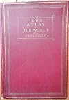
Being an atlas which today is mostly of nostalgic value. The maps were state-of-the-art in their day and are still very usable. The most inadequate aspect is the gazetteer, which, especially outside of the US, doesn't come close to listing all of the cities and physical features on the maps.

When I was probably five or so, you could get a new volume in this series at the grocery store (like Price Chopper or something?) for a couple bucks with some amount of groceries, maybe every month or so. (Mom, feel free to chime in with the details. I was pretty vague on the whole thing at the time: I was more or less under the impression that the grocery store was specifically for handing these out to me.) I got almost the whole 22ish-volume set; the one or two volumes I was missing caused show more me untold pain and anxiety. I looooooooooved them. This encyclopedia is why I grew up obsessed with things like pangolins.
Which by the way if you were wondering what to get me for Christmas, that's what I want. show less
Which by the way if you were wondering what to get me for Christmas, that's what I want. show less

Each of these 25 booklets presents a brief biography with black and white sketches of the artist and his work. Most of it, however, consists of full-size plates in full color of the artist's notable works. Terrific for an art history class at most levels of education.
This atlas might be useful for railroad buffs because for each map it shows railroads, not roads. The federal highway numbering system began in 1928.
Also interesting are the airline routes shown on the last few pages that indicate if the route carries mail, passengers or express
Also interesting are the airline routes shown on the last few pages that indicate if the route carries mail, passengers or express
You May Also Like


Associated Authors
Statistics
- Works
- 378
- Also by
- 1
- Members
- 2,192
- Popularity
- #11,705
- Rating
- 3.9
- Reviews
- 13
- ISBNs
- 61
- Languages
- 1
- Favorited
- 1