Atlas of Remote Islands: Fifty Islands I Have Never Set Foot on and Never Will
by Judith Schalansky
On This Page
Description
For each island, this book provides information on its distance from the mainland, whether its inhabited, its features, and the stories that have shaped its lore.Tags
Recommendations


Member Recommendations

by anonymous user
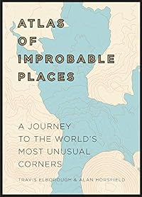
Oct326 Non c'è sovrapposizione tra i luoghi trattati in questi due libri, ma c'è tra i concetti: l'insieme dei "luoghi maledetti" e quello delle "isole remote" hanno certamente intersezione non vuota. Ecco perché chi è interessato ad uno può esserlo anche all'altro. Schalansky li tratta con stile sobrio, Le Carrer con ironia e leggerezza, ed entrambi li presentano con una grafica curata e di ottima qualità.
Nickelini One is straight fiction, the other is mostly factual, but there is a certain air and tone about them in common, and they are likely to appeal to the same reader.

CGlanovsky Little vignettes about places. Calvino's are more fanciful and there's a twist, while Schalansky's are little anecdotes based on actual bizarre and out-of-the-way places.
Member Reviews
A book called A Mapmaker's Dream by James Cowan tells a tale about a Renaissance monk Fra Mauro who lived and worked at St. Michael's Monastery on the Venetian island of Murano. He chose cartography as his religious vocation, but ironically his vows prevented him from traveling to gather information for his maps. Instead, travelers came to him. His life's work was a famous mappamundi (world map), which became an encyclopedic compendium of illustrations of and inscriptions about the known world in 1450.
Fast forward to the late twentieth century, East Germany before the Berlin wall fell, where the only people allowed to travel abroad were members of the Olympic team. A young girl entertains herself by pouring over an atlas of the world, show more filled with lands of many colors and blue oceans dotted with tiny islands named exotically, perhaps as a charm to prevent them from disappearing entirely in the blue vastness. It transports her to remote destinations.
Even after the fall of the wall and travel abroad suddenly becomes possible, "I had already grown used to traveling through the atlas by finger, whispering foreign names to myself as I conquered distant worlds in my parents' sitting room.”
Years later while studying graphic design this map lover chanced upon a cartographer's detailed sketch of a small island.
I imagined that the cartographer must have had to sketch this island, before he tried his hand at the mainland. It struck me for the first time that islands are in fact small continents, and that continents are in turn no more than very large islands. This clearly outlined piece of land was quite perfect and yet lost at the same time, like the loose sheet of paper on which it had been drawn. Every connection to the mainland had been lost. There was no mention of the rest of the world. I have never seen a lonelier place.
This describes perfectly the fifty maps of islands that make up this book, which was obviously inspired by the mapmaker's sketch.
The Atlas of Remote Islands is Judith Schalansky's book in every sense: she created the maps, she set the type and wrote the text. Knowing her story is as important to appreciating her book as knowing about the featured islands, all of which are real and whose histories are as strange and exotic to the reader as Fra Mauro's mappamundi was to his contemporaries. A hundred years after Fra Mauro, Ortelius created what is considered to be the first modern atlas of the world, the Theatrum Orbis Terrarum, or theater of the world. Schalansky's modern incarnation is an homage to the cartography of former times. The historical vignettes she has composed to accompany each island map conjure up the hopes and realities, the joys and sufferings, the dreams and nightmares of the discoverers and settlers, as do the isolated, almost iconic islands standing alone in a blue background. And for the reader:
Consulting maps can diminish the wanderlust that they awaken, as the act of looking at them can replace the act of travel. But looking at maps is much more than an act of aesthetic replacement. Anyone who opens an atlas wants everything at once, without limits — the whole world. This longing will always be great, far greater than any satisfaction to be had by attaining what is desired. Give me an atlas over a guidebook any day. There is no more poetic book in the world.
For all the imaginative pleasures that are to be found in this book, a few cautions are in order to avoid confusion. Do not look for lines of longitude or latitude, although map coordinates are stated on the facing page. While distances are given to the nearest land mass or other island, there are none of the usual map references to other geographical features. The historical vignettes are presented in the present tense, which lend an air of dreamy vagueness, but most events described took place long ago. Sometimes geographical features are mentioned which do not appear on the map, presumably because they no longer exist. Thus a disconnect arises between historical account and presumably up-to-date map.
In short, do not confuse this with a travel guide even though the publisher has mindlessly designated it “travel/reference”! Didn’t they read the text? It is intended to excite the imagination both in word and picture, to evoke dreams of wanderlust and the lore of exploration. These it accomplishes very well. The theater of the world indeed plays itself out in these remote islands. show less
The concept is fascinating: each island is drawn in exquisite detail in black, white, and orange (for cities and roads) and stranded on an expanse of pale blue. The layout evokes the isolation, the constant threat of the ocean. On the facing page is a small bit of factual information about the island: size, population, name, language, latitude & longitude, distances from three nearest land masses, and a timeline of its discovery. Below that is the text of the book, a single paragraph telling the story of a single aspect of the island. It is brief, clipped almost, and highly poetic prose that sometimes borders on cliché (“feathered tribe” for example) and I wonder about the translator striking that balance between accessibly poetic show more and trite. Though the language can get saccharine (an unusual problem in my experience of translations from German, so something I definitely wondered about) the facts are exquisitely chosen.
In some cases she focuses on the people, or a person: a horrifying historical event (hundreds of babies dying of tetanus), or something so surreal as to be unbelievable (Marc Liblin learning Rapa in his dreams as a six year old living in France). Sometimes its an environmental disaster, or surprising geographical feature. Very few are unremarkable – like most books intended for a mass market audience the pieces are dense with sensationalism disguised as fact. And some of these stories are easily verified by internet searching (the tetanus epidemic), and the sensationalism of the telling becomes quickly justified. But others, like the Marc Liblin story, is more or less unverifiable.
As a proponent of lying in creative non-fiction it doesn’t trouble me too much. The idea is the more important thing, and stories can have an emotional truth without having a journalistic truth. She asserts as much in the introduction:
“That’s why the question whether these stories are ‘true’ is misleading. All text in the book is based on extensive research and every detail stems from factual sources. I have not invented anything. However I was the discoverer of the sources, researching them through ancient and rare books and I have transformed the texts and appropriated them as sailors appropriate the lands they discover.” (20)
Of course the Marc Liblin story takes place in the 1960s, so sources would not have been in “ancient and rare books,” and yet the only hits from a google search are other reviews of this book. So what. The story has all the resonance of a Borges story, and for that reason I accept it as an imaginative truth if nothing else.
[Read the whole review: http://alluringlyshort.com/2013/06/15/atlas-of-remote-islands-by-judith-schlanas.... ] show less
Atlas of Remote Islands
Judith Schlansky
Penguin
The first thing that struck me about Judith Schlansky's Atlas of Remote Islands was its physical beauty, a study in orange and blue that is a lot more appealing than it sounds. The type font is a joy to look at and to read, but really I expected no less from the author and designer of [Fraktur Mon Amour]. Each map of the 50 islands in the book is featured on its own individual page surrounded by a sea of blue as if it's the only place left in the world.
In her preface she introduces her love of maps and their infinite possibilities, particularly islands. Schlansky has a mesmerizing way of writing that made me almost want to take off for the great unknown, however as she notes an island can show more be paradise and hell. In writing about each of these fifty islands she manages to make a study of the strengths and weaknesses of the human character. From hermits in artic regions, to self-made empresses, from islands where inhabitants depart on suicidal treks to maintain the ecological balance of their home, to one where the inhabitants refuse to leave even though their home is sinking beneath the waves. I read this book on a snowbound day with a pot of tea beside me. Highly recommended. show less
I think I expected something different from this book, alas. It's beautifully designed, and the maps are lovely, but the idiosyncratic essays about each island were just a bit too offbeat for me.
Born in what was East Germany and hemmed in by politics and the Berlin Wall, as a child Judith Schalansky’s only way of traveling the world was to explore with atlases. In creating her own idiosyncratic atlas of islands Schalansky has drawn on her own memories and experiences of those earlier atlases.
The 50 islands included in this atlas represent all the world’s oceans, and are varying degrees of small – the largest is 297km² down to the smallest at just 0.8km². This a beautiful book with plenty of attention given to the details. Each island is presented on a 2 page spread. One page for a gorgeous map with topography, main roads, airstrips and settlements (and their relative size) all rendered with deceptive simplicity. The show more second page indicates the distance to 3 more locations, has a timeline of the islands history or notable events, latitude and longitude, a globe with the islands location indicated and a half page write up on some aspect of the islands history, culture or geography.
The stories of each island are varied and interesting, sometimes amusing and often contain some comment on human nature. Schalansky generally shies away from writing about the expected. The mutiny of the Bounty’s crew is of course mentioned for Pitcairn Island, but 2/3 of the text focuses on Marlon Brando’s portrayal of Christian Fletcher in the 1962 film, and there is no mention of Australian immigration issues on Christmas Island.
Two things about the information in this book constantly amazed me. One was the number of tiny atolls that had an airstrip precariously balanced between the sea and lagoon, and secondly the number of people living on tiny islets. In the case of Tikopia in the Solomon Islands, 1200 people inhabit a mere 4.7km², and in order to keep the delicate balance they practice various forms of population control including suicide trips out to sea in times of drought or after a destructive storm.
I'd love to know how Schalansky selected the islands covered in this book, and since there were more than a few I'd never heard of, how she began her search for potential islands in the first place.
Atlas Of Remote Islands is beautifully crafted and presented, and it's wealth of eccentric information make it a fascinating read. There's much more information packed into this book than it first appears. This is a gem of a book that above all celebrates human exploration, which extends to some of the harshest, most remote corners of the globe. show less
I have a deep fascination for islands, preferably small, isolated and inhabited by a handful of people. I also love maps, preferably detailed and hand drawn, with many names of places put on them. This book is an orgy in both these things.
It’s also like a bag of potato chips. Each island gets just one page of text and one page of map. It’s impossible to just read about one or two. I gulp this book down instead of savoring it. But the potato chip analogy is also very irreverent. Because quite frankly, this is probably the most beautiful book I own. Designed by the author, it’s truly a piece of art. The maps are gorgeous, detailed grey islands with orange details surrounded by grayish blue sea. Down to the choice of font, everything show more here is perfection.
Each island get a single page of text, but rather than trying to tell *the* story of each place, Schalansky tells *a* story. Usually it’s a snapshot of a single event or a description of an aspect of the island. Some places and stories are obvious: the propaganda stunt of raising a flag on Iwo Jima. The death of Napoleon on St. Helena. The ecological disaster of the statue building race on Rapa Nui. But there are also tons of stories, big and small, that are completely new to me. An imperialistic human rights violation on Diego Garcia. A murder mystery on Floreana, which had five inhabitants at the time. A UFO sighting over Trindade. A german idealist getting denied when asking to buy a plot of land on Tristan de Cuhna. A man devoting his life to the futile attempt at finding pirate treasure on Cocos Island. And an anti-climactic expedition to Peter I Island – on which yet no human has ever set foot. And many many more.
A gorgeous book, filling me with wonder, longing and thoughts about nature and humanity. I can’t thank Pete (psutto) enough for pointing it out for me. show less
I discovered half way through this book that, in order to understand what the author was doing with this book, it is necessary to read the preface carefully and completely. Me, being the type of reader that I am, had initially skimmed the preface, and was half way through the body of the work when I realized how important the preface was in understanding this perspective. But, also being the type of reader I am, I had to first finish reading it, and then go back and re-read the preface, followed by selective review of some of the writings. Through that first reading, I understood that the author, Judith Schalansky, was from the German Democratic Republic (East Germany) and was a dreamer of travel. I could relate to that second show more characteristic. I grew up in the middle of the United States and dreamed of travel. What I hadn't realized, what I had missed, was that this is created as a literary and art piece, not as a geographical fact book. I appreciated the book better once I realized this, knowing now that it was not necessary for her to prove her facts or cite her sources. Her description of a book that her typography professor shared with her: hand-drawn and painted maps by a French cartographer from the late nineteenth century titled "I'll Tell You Everything", made me think of how everything, all work, can be approached as art. This must be what influenced her to write a creatively descriptive book of islands she would never experience personally, her imaginings of happenings which actually occurred, her own book as art.
Fifty islands are described in the book, organized by ocean and divided by an inserted map of the ocean with the islands marked. The endpapers of the book are a bigger picture of this same concept: a map of half the world with islands marked as the front endpaper and the other half in the back. Each island is given two pages of written and illustrated attention. The first page has a paragraph-long vignette of some historical event relating to the island along with geographic information on the island's size, population, distance from other lands, and historical timeline of events. The facing page is a mostly colorless illustration of the island set in a blue ocean background lacking both latitudinal and longitudinal markings. The emotions expressed through the writing and illustrations are that these are places of isolation.
When I share this book at my monthly book group, I'll read one of the vignettes. The one I've chosen is about Floreana Island (Galapagos Island group) where Schalansky tells the story of two Europeans, a teacher and a dentist, who leave their spouses and move to the island in 1929 to live an isolated lifestyle. Eventually a "self-proclaimed baroness, a good-time girl with big teeth and thin eyebrows" arrives with her two lovers and disrupts the tranquility of the place, eventually this invasion ends in multiple deaths and disappearances.
I liked this book immensely, especially after I understood what the author/artist was doing with it. Another similar book that I have read, which describes geological terms in literary language, is the book "Home Ground: Language for and American Landscape", edited by Barry Lopez. This book is an encyclopedia of geological terms with each term defined by different authors in non-scientific language. Here is a sample from this book: "jaral. You have seen the jaral in a score of spaghetti westerns. These Italian genre movies made great use of the vast desertlike vistas found in the western Mediterranean landscapes of Spain. As in the American Southwest, place-names trace the progress of conquest: the jaral became the Texan-New Mexican land where sandy soil supported low sparse shrubs of the same type found in Spain ... In microcosm, a jaral can be a willow thicket on a sand bank ..." (written by Luis Alberto Urrea). If you like "Atlas of Remote Islands", you'll probably find gems in "Home Ground" to enjoy. show less
Members
- Recently Added By
Published Reviews
ThingScore 100
Med sina poetiska, lätt absurda berättelser kan ”Atlas över avlägsna öar” föra tankarna till Italo Calvinos ”De osynliga städerna”, där Marco Polo berättar för Kublai Khan om alla städer han besökt under sina resor. Fast här handlar det alltså om fastlandets fotnoter. Calvino hade älskat den. Xavier de Maistre också.
added by Jannes
Judith Schalansky has chosen to incubate the minds of people who map islands. Curled up behind their eyeballs, she has let herself be carried around the globe from Lonely island in the Arctic to Deception in the Antarctic. Although she travels like Jules Verne, she describes each lonely deceptive landfall like Jorge Luis Borges. . . The writing is mercurial and bewitching. Almost as good as a map.
added by mysterymax
In her foreword, Schalansky describes the act of finger-walking a map as an "erotic gesture". Cartophiles will know instantly what she means: not that there is a sexual frisson involved in map-reading, but that the distant longing for a landscape is usually far greater than the satisfaction gained by reaching it (eroticism's essence being anticipation rather than consummation). "There is no show more more poetic book than an atlas," Schalansky writes, and her book makes a magnificent case for the atlas to be recognised as literature, worthy of its original name – theatrum orbis terrarum, "the theatre of the world". show less
added by mysterymax
Lists

Recommend the 20 best books you've read in the last five years
2,167 works; 606 members

Roads not travelled
11 works; 2 members
Evan's Wish List
86 works; 2 members

Books recommended by Calgary Public Library staff
1,588 works; 4 members

Die besten Werke der deutschsprachigen Erzählliteratur von 1924 bis 2024
100 works; 2 members

Sense of place
156 works; 13 members
Author Information

30+ Works 1,993 Members
Some Editions
Awards and Honors
Common Knowledge
- Canonical title
- Atlas of Remote Islands: Fifty Islands I Have Never Set Foot on and Never Will
- Original title
- Atlas der abgelegenen Inseln
- Original publication date
- 2009
- Important places
- Bear Island, Norway (Bjø | rnø | ja); Lonely Island, Kara Sea, Russia (Uyedineniya Island)
- First words
- I grew up with an atlas.
- Last words*
- (Click to show. Warning: May contain spoilers.)Mehr ist nicht zu sagen über unbetretenes Land.
- Original language
- German
*Some information comes from Common Knowledge in other languages. Click "Edit" for more information.
Classifications
- Genres
- Travel, Nonfiction
- DDC/MDS
- 910.914 — History & geography Geography & travel modified standard subdivisions of Geography and travel History, geographic treatment, biography - Discovery. exploration Geography of and travel in areas, regions, places in general Land, Landforms
- LCC
- G500 .S3313 — Geography, Anthropology and Recreation Geography (General) Special voyages and travels
- BISAC
Statistics
- Members
- 1,134
- Popularity
- 22,069
- Reviews
- 45
- Rating
- (4.19)
- Languages
- 13 — Chinese, Czech, Danish, Dutch, English, Finnish, French, German, Italian, Norwegian (Bokmål), Polish, Spanish, Swedish
- Media
- Paper, Ebook
- ISBNs
- 26
- ASINs
- 7